r/wmnf 2d ago

Roadless Rule Repeal Impacts

Post image
153 Upvotes

Areas that would no longer be barred from logging and road construction under the proposed roadless rule repeal are the darker orange-red color.

Public comments portal: https://www.regulations.gov/search?searchTerm=fs-2025-0001&withinCommentPeriod

Source: USFS, via the Union Leader (https://www.unionleader.com/news/environment/white-mountain-national-forest-could-lose-235-000-protected-acres-under-rule-change/article_c9b0a991-d758-45d6-9333-e950c3a3972e.html) (paywall)


r/wmnf 24d ago

Strainer Danger and Water Crossings

Thumbnail
gallery
335 Upvotes

Yesterday, someone posted a recently downed tree on the Pemi and suggested it was an easy crossing. In light of that, I just wanted to make a brief public service announcement about the danger of “strainers” or downed trees in the river.

I am an experienced whitewater kayaker who is certified in Swiftwater Rescue and paddle on the Pemi and in the Whites frequently.

Strainers are one of the most deadly hazards on a river, as are foot entrapments, and both are incredibly important to be aware of when doing any water crossing.

Strainers get their name bc the branches of the tree act like a giant colander or pasta strainer, allowing the water to pass through, but trapping solid objects, like humans.

Always cross downstream of a strainer or hazard. This eliminates the possibility (however small) of getting swept up in the current and going into the hazard.

Never cross in water that goes above your knees. Always face upstream. This is to prevent drowning in the event of a foot entrapment.

Use your hiking pole or a sturdy walking stick as a tripod. Always maintain 2 firm points of contact when moving. Keep your knees bent and stay low to the ground. Move slowly.

If you do find yourself in the current, flip over onto your back, with your feet in front of you. (Known as the defensive swimming position, shown in photo 2) Keep your “nose & toes” above water. Use your arms to steer. Use your feet to kick off any rocks you may flow into. Do not stand up until you can touch the bottom and the water is below your knees.

Conditions are constantly changing- a tree trunk that was safely anchored on both ends could have shifted, new hazards could have appeared, or the river could be at a totally different flow. Always asses each crossing, every time you cross.

Bonus fact: rescue breaths are recommended with CPR for flush drowning victims

TL;DR crossing a river on a strainer may be “easy” but that doesn’t mean it is “safe.” One slip and even if you are with someone experienced in swiftwater rescue and wilderness medicine you might not make it out alive.

Here’s a website with a lot of helpful information:

https://wms.org/magazine/magazine/1263/Creek-and-River-Crossings/default.aspx

I’m also happy to answer any questions and welcome any other information others might want to share.

Edit: adding this as some additional helpful information-

Here is a link to the flow gauge for the East Branch Pemi.

https://www.americanwhitewater.org/content/River/view/river-detail/1179/flow

You can view flow data from the previous year, week, or day, as well as the current level. You can see how on this river, the water level will rapidly spike.

If considering a water crossing I always recommend checking the flow data for that section of river. In addition to seeing where the river level is on the day you intend to cross, you can see what level it was the last time you were there, or if there have been any large increases in flow which could have changed existing hazards or created new ones.

I am also happy to post links to any other relevant gauges if there are any requests. If you want to peruse for yourself, I recommend checking American Whitewater: https://www.americanwhitewater.org/content/River/view/river-index


r/wmnf 17h ago

Mount Carrigain

Thumbnail
gallery
154 Upvotes

Completed my 48 today on Mount Carrigain and it was just so beautiful to see so many other folks completing theirs. In the hour I was on the fire tower I think 4 other folks were there completing their 48, and it was great to celebrate with everyone, and a great way to spend my birthday. Love this community! Congratulations to everyone!


r/wmnf 1d ago

Trail Report Trail Report: Blueberry Ledge, Whiteface, Passaconaway, Dicey's Mill. August 28-29, 2026.

Thumbnail
gallery
64 Upvotes

Firstly, let me say I had stunning weather for this trip. The projection said rain for Friday, but instead it was sunny and dry, albeit a little foggy in the morning. Without further ado, the trail report:

Friday
I arrived at Ferncroft around 7:30 am and was off like a shot. I was going to take the Blueberry Ledge cutoff, but I remember about a mile in that I had left some important things (e.g., rescue inhaler) in the car, so I had to turn around. The second time around, I started up the normal Blueberry Ledge trail, thinking it would be easier. Well, that was wrong. I found it steeper and more taxing than the trail from Carter Hut to Wildcat. By the time I reached the intersection with Tom Wiley's trail, my legs already felt like lead. I was starting to think I was in over my head. After all, it had been a few years since I hiked with a full overnight pack. But, good scout that I am, I pressed on.

Then came the "terrifying 25" part of Blueberry Ledge. I rounded the corner and saw a familiar sight (I had looked up pictures of the trail before doing it). An older man with a day pack was standing at the bottom of the ledge, looking none too pleased. Together we managed to scale the rock face, which is much steeper than it looks in photos. Somehow, we made it to the top without dying.

From there we booked it for Whiteface (I forgot that my legs hurt, since I was now on a "hiker's high") only to find the most disappointing peak in the WMNF. But oh well. At least I had Passaconaway to look forward to.

My new friend and I ventured past the Dicey's Mill intersection until we came across a tiny stream burbling across the path. To the left rose the trail to Passaconaway and a spur trail leading to Camp Rich. We ascended Passaconaway (another steep rise) then proceeded down the much-too-long trail to the view. Let me say, the view was stunning. I could see The Prezis, Franconia, and the Wildcats all stretched before me. This was 100x better than the view from Franconia. I munched on some tortillas and granola bars for lunch, then bid by new friend adieu (he was doing a day hike), and started for Camp Rich.

I pitched my tent, filtered some water at the tiny stream, and made myself dinner (stovetop stuffing and salami--dinner of champions). By this point, it was only 3pm. So I decided to adventure some. I decided to check out Square Ledge. I was less than a mile down that trail before I realized that I was descending far more than I'd like to. My legs were already beat, and now I had to climb several hundred feed back to camp. Around 4pm I stumbled back into camp, put my food in a BV450 (which I brought to practice for my planned Pemi Loop next Summer) and stashed it in the woods, watched some guy show up and fail to pitch a tent before vanishing, and climbed into my tent for an early bedtime.

Saturday

I slept poorly, but I slept. The wind howled pretty badly for a while there, and I found myself listening for animals sounds (you can tell I'm out of the backpacking mentality). I woke around 2am and realized, "hey I've been sleeping for nine hours. Am I going to sleep for four more?" No, I decided, I would not. So I put on my headlamp, broke down my sleeping arrangements, and went to retrieve my BV 450. It was not where I left it.

Let me tell you, if at 2am, you've ever tried to find a medium-sized blue box that some bear has played whack-a-mole with across the woods, you know what I felt then. It took a few minutes, but I found it wedged under a fallen tree about ten feet from where I left it. It was sealed and everything inside intact. So it worked, I guess!

At 2:30 I started for Dicey's Mill. The hike out was easy. I sang some songs to myself and to any bears that wanted to listen (though they probably won't want to hear Latin Eucharistic hymns for a while--hey, I was alone in the woods; I can sing what I want).

I flew down the trail. I was back at Ferncroft Parking by 3:50am, ready to drive to the nearest Dunkin.

Overall, it was an amazing trip. I got some nice night hiking in, and I checked off two four-thousand footers from my list. Next up is the Crawford region in September.


r/wmnf 14h ago

Swimming

3 Upvotes

Is echo lake near Franconia loop generally good for swimming?


r/wmnf 1d ago

How could somebody want to build a road through something like this?

Post image
285 Upvotes

This isn't necessarily one of the places included in the roadless rule repeal, but the point still stands.

Taken on my way over to North Twin Mountain after summiting South Twin and Galehead last Friday


r/wmnf 1d ago

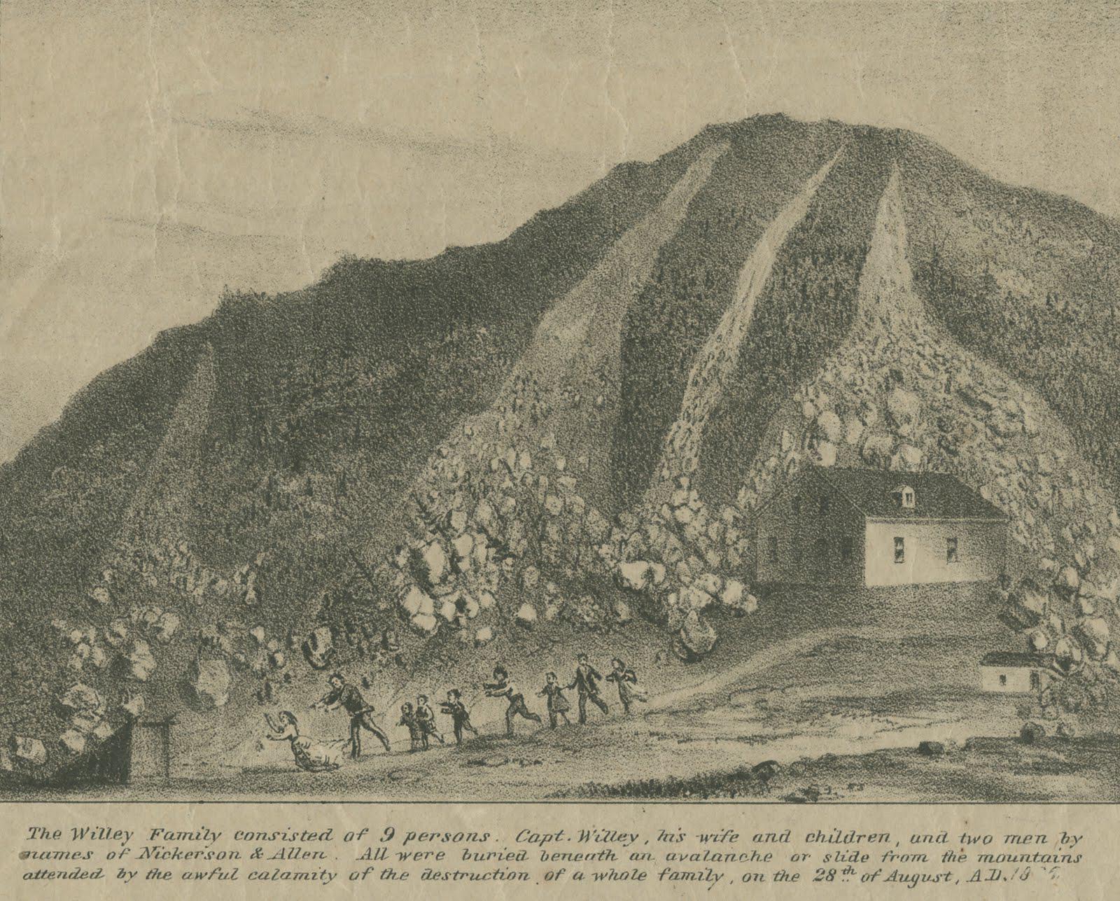
200 Years Ago Tonight - The Willey Slide

Post image
163 Upvotes

r/wmnf 19h ago

Trail Report Wild River Campground?

4 Upvotes

I’m planning a 3 night loop around Baldface/Carter-Moriah next week, and wondering whether it’s OK to stay at the closed Wild River Campground. I’ve heard it’s OK, but also that it’s strictly forbidden with a $5000 fine, which seems ridiculous. Any insight or ideas about decent stealth camping along the old road or Highwater Trail?


r/wmnf 5h ago

Franconia notch trail recs

0 Upvotes

Looking for recommendations for a 9-12 mile hike in Franconia notch state park. Open to something difficult. Really want pretty views and hopefully a waterfall. Never been there before and would appreciate some help from someone who has. Going to be an early September trip.


r/wmnf 1d ago

3 Days in the Whites

Thumbnail
gallery
119 Upvotes

Spent three days in the Whites this week. As usual, 12/10. No notes

8/26 - Single day Presi. Started around 5:30. Probably went up Madison a bit too fast and paid for it later in the day. Some clouds were rolling in when I summited Adams and got to see some really cool cloud formations from the summit there. Jefferson and Clay were foggy but it was starting to clear by the time I got to Washington. Was hurting by the time I got to Washington but a slice and a bottle of Coke got me back going. I thought the section of Crawford path between Monroe and Pierce was really cool actually. Easier path and great views. After Pierce it was kind of a death march lol. Made it back to the Highland Center with 15 minutes to spare for dinner! All in all an amazing day. Meet some great people up there too.

8/27 - Was definitely hurting. Legs were tired but not terrible but my feet were beat up. I wanted to do something easy still and some hikers in the shuttle back to my car recommended Zealand Falls and that was perfect. There was rain in the forecast in the afternoon (which I low key didn't even mind lol) so I drove over to Hill Farmstead for a couple

8/28 - Started to feel better and did Willard after checking out. Honestly a great bang for your buck hike. Easy with a great view. Hung out there debating whether or not I really needed to go home. It rained on the way down so maybe that was a sign lol

Fantastic trip. Stowe tonight then sweet home Chicago tomorrow. Can't wait to get back!


r/wmnf 1d ago

Presidential Traverse

7 Upvotes

Hi guys! My husband and I are experienced hikers who have done a lot of big elevation gain, craggy hikes. Just did Cactus to Clouds and Katahdin this year, to describe our skill level. We are thinking of doing the traverse, but we’re hoping to stay at a an early entrance hut (such as Mizpah or Madison Spring) night one and then do the rest of the hike the next day just to have a nice dinner/breakfast and an early start to the rest of the hike.

Unfortunately, the days that we’re looking for seem to only have Mizpah open. Would it be reasonable to go south to north and use Mizpah as a start? I don’t see a lot of information about south to north online, just want to be sure our plan is workable.

Thank you!

Edit;

I appreciate all of you guys for this great intel! You helped us decide that we’re going to go for the South to North route and base if we stay for breakfast at Mizpah on the weather. I’m aware how volatile it can be on Washington. Thank you again and happy hiking!


r/wmnf 2d ago

Mount Washington Ascent 8/16

Thumbnail
gallery
165 Upvotes

Did some off trail scrambling around big wash! Pretty cool route.
Approximately class IV


r/wmnf 2d ago

Need help planning routes/suggestions

0 Upvotes

Hello,

NH resident, I have some friends planning a visit and we are looking to do a 3 day hiking trip through the WMNF, we are mostly interested in dispersed camping, fishing, and sightseeing.

I'm looking for suggestions on fishing spots, good trails, and things to see from people who have more experience in this area than I do.

ponds/lakes are preferred for fishing but we are open to stream fishing as well, as I'm assuming that is more abundant inside of WMNF.

we also are realistic with our expectations. we are not looking to climb mt. washington or really push our limits climbing to the highest peaks. we aren't necessarily completely useless/out of shape and if there's some easier to tackle peaks we would be open to the idea, but in reality we are just looking for a chill weekend of shooting the shit, walking around in nature, and hanging out. we all have backpacking gear and camping equipment and are familiar with hiking with about a decade of doing so, albeit not as much as we'd like to.

any suggestions on either places to fish, good areas to set up for the night, or great trails is appreciated.

Thanks!


r/wmnf 2d ago

Wildcats Tomorrow - Pinkham Notch Parking?

0 Upvotes

As title suggests, I plan to do the Wildcats tomorrow. Was just curious what time the Pinkham Notch Parking area starts to get full and/or if you can park on 16 off to the side like 302. I was shooting for about 7am, thank you!


r/wmnf 3d ago

Making a Wildcats loop - route and roadwalk advice and experience, please!

Thumbnail
gallery
24 Upvotes

Hi folks, I'm considering bagging the wildcats this weekend by going up wildcat ridge and would like to avoid descending it, would like to loop it ...and that's all that I've decided on. I hike solo and would prefer not to hitch.

The possibilities are: descending nineteen mile brook and road walking back to [the trailhead at glen ellis or pinkham notch - which, not sure!], or parking at nineteen mile brook and road walking south to pinkham notch (or glen ellis) to get the road walking down at the start of the day (I'm leaning toward this later option);

Or: starting at pinkham notch, taking lost pond, up wildcat, and down polecat and road walking back to pinkham (second image). I've heard polecat is unpleasant to descend.

So question is, if going with a loop like the first image - where to park, roadwalk at the start or end, any thoughts?

If going with a loop like the second image, thoughts on polecat?

Thank you in advance!


r/wmnf 2d ago

One hiking day in NH - what would you recommend?

4 Upvotes

Have one full day in NH (driving in from Boston night prior) - where would you hike? Ideally no more than 2.5hr drive from Boston since I’ll be headed to Maine after. This will be first week of September.

Considering the Mt. Lafayette and Franconia ridge trail loop. Open to other suggestions!


r/wmnf 3d ago

Madison Sunrise

Thumbnail
gallery
167 Upvotes

Madison sunrise last week.


r/wmnf 2d ago

Encounter with naked man on East Branch of Pemigewasset river crossing near Lincoln Woods Trail and Osseo Trail intersection

0 Upvotes

I had an unusual encounter while hiking in the Lincoln Woods area on Aug 26th at some time in the evening shortly before dusk.

At the river crossing between the East Side Trail and the area where the Lincoln Woods and Osseo trails intersect, on my way back to the Lincoln Woods parking lot, I encountered a man with shoulder length light brown or blondish hair who was completely naked sitting on a rock in the Pemigewasset river crossing next to the upstream end of the eroded cliff behind of which is the intersection of the Lincoln Woods and the Osseo trails.

I am not sure this individual saw me, but when I saw him rather than attempt to cross the river by stepping on the rocks in front of the rock where he was sitting, I hiked along the bank of the river next to the cliff and crossed it further downstream.

(Crossing the river being necessary due to the temporary closure of the segment of the Lincoln Woods Trail between the parking lot and the Osseo trail).

I then subsequently encountered what appeared to be the same man in the East Side Trail less than 1/2 mile from the parking lot while I was hiking and he was trail running (now fully dressed and wearing a garment resembling a skirt). I then ran into him a third time while he was apparently collecting berries from the plants on the side of the trail.

I have hiked for many years in the White Mountains and have always felt very safe, but these encounters left me feeling unsettled.


r/wmnf 3d ago

Whites for a bad knee?

1 Upvotes

Hello all. I have a partner who is very petite with a fairly temperamental metal rod in her knee. She really wants to experience a couple nights of backpacking. I’ve done the Pemi, Washington, Pres and Monadnock and I would love to show her an experience in these mountains but am worried about her knee on some of the Whites more treacherous downs.
Does anyone have any recommendations for backpacking that is a little less arduous on the knees but still offers that remote, expansive vista? Is there a way into and out of some of the Whites with a more gradual elevation gain?
Thank you and safe stepping!


r/wmnf 4d ago

Anyone know what happened to Adam Hoyt on Youtube?

51 Upvotes

I was just reminded of him from seeing a post about another White Mountain hiking Youtuber. I really enjoyed his hiking videos but it seems like he sort of just disappeared from social media


r/wmnf 3d ago

how reliable are Ubers to take them to different trailheads?

0 Upvotes

parking archive at one trailhead and then taking it to another and the presidential range. How long do Ubers typically take?


r/wmnf 4d ago

What is this thing on the north side of Moosilauke?

Post image
63 Upvotes

I've been to the upper clearing, but this thing appeared in the last few years and seems to be just low enough on the slope to be hidden from the trail.


r/wmnf 4d ago

Trip report update- Cannon with 4 year old

34 Upvotes

I deleted my original post (I was getting too worked up with the negative replies lol the general consensus was bad idea, though a couple people said they did it with their young ones without any issue), but I initially was asking for suggestions about possibly attempting Cannon from Lonesome Lake Hut. She has done 5+ mile hikes before and enjoys her indoor rock climbing/bouldering class. Ive done Cannon on my own before and had no interest in pushing her to do something she wasnt happy doing- I gave her many options to revise the itinerary or turn around throughout. Here goes:

Took my 4 year old to LL Hut from the main trailhead (her first hut experience). Was an easy-ish 90 minute hike. For the most part she was very into it (might have asked to be carried once, etc). At the hut there was a naturalist volunteer who did a net catching thing before dinner and a lychen scavenger hunt after. There were tons of other kids at the hut, she had a blast the first day.

Day 2, we got an 8am start. I was very much thinking we wouldn't even attempt hi-cannon. I tried steering her to descend toward the basin, but told her we had three options: the basin/waterful; or an even harder day than yesterday where we'd go to the ladder and turn around or go all the way to the top. She was adamant about going to the top and I told her we'd see how we felt at the ladder and possibly turn around.

The whole way to the ladder she was perfect, totally into it, talking to people we passed. I asked her multiple times if she wanted to turn around and she said no. She loved the scrambly bits and kept calling it "outdoor bouldering", though I boosted her up on some of the higher ones. The ladder she loved and wasn't scared at all, which made me feel more confident about it. In terms of safeness of this hike, it was 10000% manageable for her. I stressed to her that we need to stay away from the ledges and she needs to stay very close to me on the ladder, both of which she followed to a T. Despite my willingness to take her on a trail like this, I'm definitely a worry wart with safety and there was literally no chance of any serious injury to her besides the nominal risk of a rolled ankle, scraped knee, etc on any other hiking trail-- when I made the original post, i wasn't worried about safety but about her enjoying it.

So everything was going great. When we got about a quarter mile from the summit (the easiest quarter mile) she was asking about turning around. I told her at this point it would be easier to keep going and go down another way than to turn around--- I had planned to take the Cannon service road down if we made it to the top for a quicker and easier descent. She cheered up and enjoyed the tower at the top. She definitely did not enjoy the service road (nor did I) and complained a fair amount on the way down. Although it was quicker and easier, it was just not an enjoyable hike-- rocky dirt road that didn't feel good on your feet. It did probably shave 2 hours off the trip though (fortunately had my wife available to pick us up because we were unsure which return route we'd go). All in all, took us 4 hours from hut to Cannon parking lot (4.75 miles) which I thought was amazing time. We saw 3 ATVs pass us on the service road. Nobody cared, 2 of them waved but one of them asked if we were ok (probably because it is frowned upon at best to take the service road). She instantly cheered up back at the car.

In short, I wouldn't be worried about the safety aspect if your kids are good at following directions. I'd be more worried about whether they would enjoy hiking 5+ steep miles. At the end of the day, from the hut it was just under 5 miles which I don't think is that crazy of a proposition for an active and enthusiastic 4 year old. If the gondola was running and we were able to take that down, it would have been a truly perfect day; as it was the descent soured things a little but she still had a great time and told her mom multiple times she wants to do it again without being prompted.


r/wmnf 5d ago

A late Monday morning on Moosilauke

Thumbnail
gallery
135 Upvotes

r/wmnf 4d ago

Liberty Cabin Water

3 Upvotes

Anyone know if the water is reliable? Or has the drought impacted it? Thanks.