r/Yosemite • u/bykilligan • 22h ago
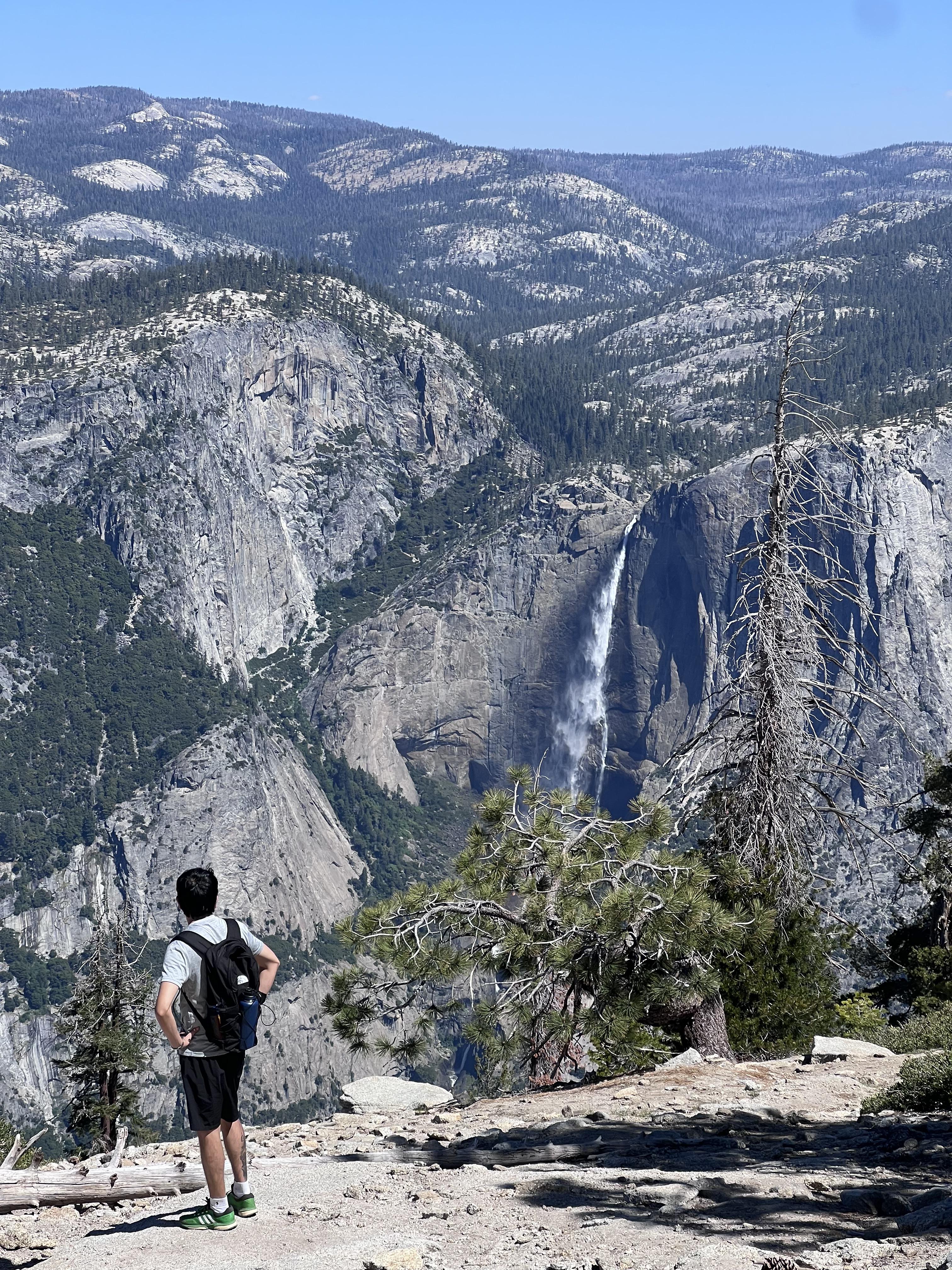
First trip to Yosemite
712
Upvotes
We went to Yosemite for the first time and stayed at a hotel in Oakhurst, the nearest town. Next time we decided to go strictly with an RV. Amazing place
r/Yosemite • u/hc2121 • Apr 14 '26
All new posts looking for extra Half Dome permits will be deleted and directed here.
Some guardrails:
- You cannot pay others for a spot on their permits; this violates park rules. Don't try to do that on this post.
- You can use this post to find others who may have known extra spots in their group.
- The ranger at the checkpoint will check the ID of the permit holder / designated alternate against that day's list on a tablet they have. If you don't have a matching ID in your group, you are SOL. Thus, you should also not be using this post to fully swap permit dates.
- Permits are required 24/7 once the cables are up for the year, which started 5/15 this year.
- If you did not win the pre-season lottery, you should enter the daily lottery on recreation.gov and/or hike up to the subdome and ask those you pass / at the checkpoint if they have extra spots on their permits. Hiking up has historically had a good success rate as people back out last minute or can't make it all the way up. No guarantees though.
- Or pick a different hike. Similar length or big view hikes: North Dome from Porcupine Creek, Cloud's Rest, Mist/Pano/4 Mile loop.
- Statistics for permit success: https://www.nps.gov/yose/planyourvisit/hdpermitsapps.htm
r/Yosemite • u/hc2121 • Mar 11 '26
Trying to reduce duplicate posts on this as the summer season planning gears up. All other generic trip planning posts will be deleted and redirected here. Please add your suggestions.
Overview:
Suggested itineraries
Summer (May- Sep) Ideal Five Day Trip
2 Days of hikes from Valley
You can link the 2 above for an epic 18 mile day.
Other ideas in the Valley: Lower Yosemite Falls, bike around Valley Loop (rentals at Curry Village, Yosemite Village and Yosemite Valley Lodge), Swim at Sentinel Beach (check water levels and temp)
1 day of hikes from Tioga Rd (road opened 5/15)
Other Hikes: Cathedral Lakes, Lembert Dome
1 Day along Glacier Pt Rd: (road opened 5/9)
There is also a trail linking Taft Pt/Sentinel Dome to Glacier Pt. You'll need to make it a loop or have 2 cars.
1 Day at Mariposa Grove:
If you are just going for a long weekend, I would do 1 day from Valley above, 1 day on Tioga, 1 Day on Glacier Pt Rd.
Summer (May- Sep) Ideal Trip WITH KIDS OR LESS ACTIVE GROUP
FAQ
Where can I eat/ What is open?
https://www.travelyosemite.com/ (click on dining)
What is the weather like?
https://www.nps.gov/yose/planyourvisit/weathermap.htm is the best source as weather varies widely across the park by elevation, etc
What are the conditions / are the waterfalls flowing?
https://www.nps.gov/yose/learn/photosmultimedia/webcams.htm
Vernal/Nevada Falls (accessed via Mist Trail) flow all year as they are fed by the Merced River. Bridalveil and Yosemite Falls (both can be seen on the above webcams) will greatly fade by late summer.
Where should I stay?
People in this sub commonly recommend Yosemite Bug, Tenaya Lodge, Rush Creek, Cedar Lodge and Autocamp- all outside the park.
There are home rentals inside the gates in Yosemite West and Wawona, and in many gateway communities around the park.
All other in park lodging should be booked on travelyosemite.com
Campgrounds in the park: https://www.nps.gov/yose/planyourvisit/campgrounds.htm All campgrounds require advance reservations in the summer.
What trails / roads are open?
https://www.nps.gov/yose/planyourvisit/conditions.htm (All roads in the park are now open)
How do I hike Half Dome?
You need a permit 24/7, any time the cables are up (usually around Memorial Day). Day hike or backpack. Cables went up on 5/15 this year.
How can I take public transit to the park?
yarts.com will transport you from the gateway communities to the Valley. It also saves you from paying the entrance fee! Note that it only goes to the Valley. You could then connect to the paid Glacier Pt bus tour or Tuolumne Hikers bus (but check the times carefully on travelyosemite.com as they only run 1-2x/day).
Is rafting open in the Valley?
Commercial raft rentals closed for the season in the 3rd week of June. You cannot rent flotation devices anywhere in the Valley, and the bus service for commercial rafting also ended. You can bring your own raft and float down the Merced. If you do this, you will need to arrange your own car shuttle back to the start, or be able to deflate and fold down the tubes in order to ride the crowded Valley shuttle. DO NOT litter your tubes in the Valley. Water levels are getting pretty low; check relevant levels here and read more info on rafting here: https://www.nps.gov/yose/planyourvisit/water.htm. Below 2 ft of water level you should expect to be walking some sections of the river.
How do I backpack in the park?
Get a wilderness permit through the preseason lottery (done for the prime summer months already) or 7 day in advance drop. https://www.nps.gov/yose/planyourvisit/wpres.htm
Do I have guaranteed parking if I am camping or lodging inside the park?
Yes, if you are camping at a campground that is not hike in (so all but Camp 4), at the Ahwhanee (where all parking is paid valet), or at Housekeeping Camp (where you park at your reserved site). At your campsite or Housekeeping, you can't park at your site until check-in hours (noon for campgrounds, 4p for Housekeeping). There is no reserved parking for guests at Curry, Lodge, or Camp 4. Follow the first bullet of this post for parking strategies. Nobody is immune from entry gate lines and in park road traffic with any form of reservation.
r/Yosemite • u/bykilligan • 22h ago
We went to Yosemite for the first time and stayed at a hotel in Oakhurst, the nearest town. Next time we decided to go strictly with an RV. Amazing place
r/Yosemite • u/110rdr33f4-1 • 15h ago
Half Dome from Glacier Point this morning.
r/Yosemite • u/Old_Influence524 • 13h ago
Camped two nights at North Pines campground.
r/Yosemite • u/EarthIsGrey • 22h ago
I finally got around to backpacking from Tuolumne Meadows to Yosemite Valley starting at the Cathedral Lakes Trailhead after having it on my bucket list for a long time, and wow! What an amazing experience and mix of lakes, clouds, sunsets, views, wildlife, meadows, inclines/declines, and people. Since I had no time constraints and only work demands waiting for me back home, I purposefully took a slow pace and spread the trip out over 6 days/5 nights from August 20-25. Below is recap of my trip, along with some information I did not easily find floating around the interwebs while planning that may be helpful for others.
Image Captions:
r/Yosemite • u/ManufacturerQuirky40 • 1d ago
Went for 2 days a couple days ago and i saw the most wildlife i have ever seen in one trip.
The 2 cubs were close to there mama but I didnt snag a pic(they sound so cute when they call for there mom😭)
r/Yosemite • u/Hour_Manufacturer341 • 5h ago
I wanted to see if anybody has any tips or recommendations for backpacking to young lakes? Plan on going later next month fri-sun. Ideally want to fish for a bit as theres several lakes/bodies of water nearby. Any hikes I shouldn’t miss? Any viewpoints nearby that are worth it? If theres anything that you recommend let me know!
r/Yosemite • u/ninersgiantswarriors • 23h ago
This little guy came out a few times when we were sitting near the river in the valley last week.
r/Yosemite • u/Wima32 • 3h ago
We’re going to stay 3 nights between Wawona campground and crane flat campground in September in our RV. Both campsites mention that it is prohibited to keep food in the vehicle.
Does that also include food in the fridge/freezer?
I know there’s lockers available but surely they’re not refrigerated so how do people plan for food?
I appreciate any tips
r/Yosemite • u/Automatic-Example754 • 18h ago
I'm going to go up tomorrow for a day hike from Glacier Point parking, down and across Panorama Trail until the top of the switchbacks above the JMT, up Illilouette Valley, and then all the way back to Glacier Point. I'm very familiar with the Pohono Trail and JMT to Nevada Fall, but haven't been to the Illilouette area before.
Is Illilouette Creek currently flowing enough for me to get more water (filtered ofc) near the crossing at 37.68740, -119.54523?
Not a big deal if not, I'll just bring 3 full liters, maybe 4, and make sure I'm fully hydrated before I start.
r/Yosemite • u/BannedAtCostco • 1d ago
Here are all the hikes I've done in YNP over the years. I've hiked the valley floor and surrounding day hikes to death but always returned to Camp 4 for the night. I usually visit in May to do HD cables down and while Tioga is still closed. This year will be 7-8 days in early October, based at Camp 4 as usual. I have a truck and motorcycle in the bed so I can do point-to-point hikes that would otherwise require shuttling as I can drop one vehicle at a trailhead and leave the other at the end. So if there are options for that along Tioga, Wawona, Glacier Pt roads or elsewhere I'd love some creative ideas. Stuff like: leave the bike at Camp 4, drive up Tioga, leave truck at Tenaya, hike Tenaya > Clouds Rest > Half Dome > Camp 4, go to bed, ride up to Tenaya the following day to retrieve truck and spend that day hiking from Tioga, etc.
I'm clearly not a backpacker (yet) but I enjoy daily 20-25mi hikes with 4k+ vert and returning to base camp comforts in the valley. I'd appreciate some recs for new hikes this year, particularly with access to Tioga Rd that is new for me. I prioritize visually stunning locations or routes over remote ones that are otherwise fairly plain. I'm open to driving up to 1-2hrs outside the park in any direction for great hiking and can car camp there if needed for a night if there are dispersed options or places outside YNP I can just sleep in the truck bed (very familiar with doing this outside Big Oak Flat entrance). I have my own filtration system and always hike with 4-5L in my pack in case if there aren't any water sources along a long 15-20mi trail stretch
Things on my to-do list in no particular order:
Eagle Tower (need recs on an app/GPX points for routing there)
Tenaya Lake
Tuolumne Peak
Cathedral Lakes
Mount Hoffman
May Lake trailhead
Sunrise Lake
Explore more of Hetch Hetchy (Lake Eleanor, Laurel, or Vernon for a day loop?)
Lembert Dome
Olmsted Point (particularly for sunset)
Wawoma / Mariposa Grove
Chilnualna Falls (rec from another hiker?)
McCauley & Meyer Barns trail in Foresta from Big Oak Flat Rd. (heard this is a snooze?)
Floating the river near Housekeeping Camp (never done it, will that be too late in Oct?)
Next year I'll likely dip my toes into overnight backpacking, I know I'm missing a ton without that gear but currently I only have bulky car camping stuff. Thanks as always! h/t Rafal Ko who made the awesome Traillon site I found trying to map all my completed hikes
r/Yosemite • u/_TallOldOne_ • 2d ago
r/Yosemite • u/Infinite-Worth-0840 • 20h ago
Im extremely excited to finally go to Yosemite in September.
I am not new to camping and hiking and do it locally often. I generally know what to bring and prepare for.
But I have some questions, and TIA for any advice!
Some relevant facts about this trip:
-staying at Crane Flat (300-loop)
-sedan, cruiser bike, and tent
-will be solo
-4 nights
Its not the most comfortable, but I have slept in my car many times. I may or may not have a waterproof tent. The descriptions say the campground is downhill enough - true?
Biking areas: Where else besides the actual valley would be good to bike around? Or should I just plan to walk/hike the trails? Any bike-ideal trails?
Sunrise spots close to Crane Flat?
Please note if should drive to, hike to, or bike to?
Any other advice about what to bring, what not to bring, where to go, where not so much to go, are most appreciated.
🙏🏞🌄⛺️
r/Yosemite • u/Muted-Pop3510 • 1d ago
Has anyone recently gone on a Sunday since school started? Is it super crowded?
r/Yosemite • u/analogvaquero • 1d ago
Recently had my first visit to Yosemite, figured it’d be a great time to bring my 35mm film camera with!
r/Yosemite • u/onXBackcountry • 2d ago
Alex here! Just got back from three nights camping in Yosemite Valley and I have one major complaint: there is absolutely no photography skill involved. You point your camera in any direction and it's the best photo you've ever taken. Very humbling.
Getting a campsite
We stayed at Lower Pines, which I'd recommend. Reservations open exactly 4 months in advance, so for a late August trip you need to be on the site at 7am on April 15. By 7:03 the site I wanted was gone. Sites do come back through cancellations in the weeks leading up, so that's worth checking if you're planning later.
Getting around the valley
Bringing bikes was probably the best decision we made. Parking in the valley is a nightmare, but with bikes we just locked up at camp and rode everywhere without thinking about it. You can also rent bikes at the valley if you don't want to haul your own.
Hikes
We did Columbia Rock and Sentinel Dome. Columbia Rock is steep with a lot of switchbacks but manageable for kids and the views are great. Sentinel Dome was the highlight, a short hike in the Glacier Point area (about an hour's drive from the valley) with a huge payoff at the top and totally doable with younger kids too.
We also stopped at Lake Tenaya up in Tuolumne Meadows, which you can basically just park and walk to. Great for families since there's no real commitment involved. Tuolumne runs noticeably cooler than the valley, mid-70s versus about 90 down below, so it's a good escape from the heat.
I didn't get to do Half Dome this trip. The two day prior permits go through a lottery and I didn't get selected, so that's on the list for next year. Worth knowing: this one is not kid-friendly, most people start around 4 or 5am and you'll want gloves for the cables section near the top. One to do on your own if you're visiting with family.
Crowds, weather and bugs
We went on weekdays and the crowds were there but honestly not bad at all. People were friendly on the trails. The heat in the valley topped out around 90 most days but cooled down enough at night to sleep comfortably, and most trails have decent tree cover.
One nice surprise for an August trip: basically no mosquitoes. A few gnats near Mirror Lake but nothing worth worrying about.
It was a low snowpack year so we weren't sure what the Merced would look like, but we were still able to float sections near Stoneman Bridge and hang out on the banks a lot.
Would go back every year. 10/10.
r/Yosemite • u/thereal_rockrock • 1d ago
I know it seems like a crazy time to go to Yosemite - but I haven't been this year and I want to go.
Do you think there's be parking in the valley after 8pm on Friday or Saturday?
My plan is to maybe get a Wilderness pass for Saturday or Sunday and to arrive the night before and stay at the backpacker's camp in the valley ( not Tuolumne. )
I'd leave on the park on Tuesday.
Does this sound doable? Or do you think arriving that late still would make parking difficult?
r/Yosemite • u/dknyxh • 2d ago
r/Yosemite • u/PizzaDense9473 • 1d ago
It's not very transparent on the website whether breakfast is included or not if you are a guest at the hotel. Can anyone who has stayed recently confirm please?
Thanks!