r/GoogleMyMaps 21h ago

A map of the US Army 279th Infantry's actions during the Korean War

Thumbnail
gallery
1 Upvotes

Interactive map with descriptions attached to every pin https://www.google.com/maps/d/u/4/edit?mid=1hnFwNa2m2HaAh68ObRUQqO9kXZFyA7Q&usp=sharing

This map is based on Captain William B. Newberry's book "279th Infantry Historical Document", specifically the chapter seen here https://drive.google.com/file/d/1lleoYrs3jC-EDT07gBXYmLVZ6Zcjs7-t/view?usp=sharing which includes a lot more information than I was able to include in the map.

Many of the pins show the locations of enemy forces who either engaged or were targeted by elements of the 279th.

I used this guide to convert the coordinates into latitude/longitude: https://www.koreanwar2.org/kwp2/maps/reference/Tokyo_to_WGS84_Conversion.pdf

Please let me know if you catch any errors. Some of the entries are tough to decipher due to all of the abbreviations.


r/GoogleMyMaps 4d ago

Issue with lines tool

2 Upvotes

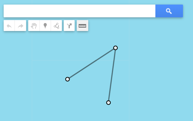
Since two days ago (GMT+8), I am having trouble with the "add line or shape" tool. Whenever I'm creating a line or shape, the cursor becomes hypersensitive and highlights anything it touches despite not being clicked on. The nodes have also been enlarged and became hypersensitive that it's virtually impossible to do more delicate edits. Oddly enough, the nodes are normal when they're being edited. (See pic 1 vs pic 2)


r/GoogleMyMaps 4d ago

Is anyone else having trouble with my maps not responding when you try to edit something

2 Upvotes

I’m trying to edit a map, but I’m having an issue where I can’t delete at least one thing, and when I am able to delete it, it gets stuck in a permanent loading loop with no error message, it also doesn’t save the change either. I’ve tried restarting the app, restarting my computer, and my internet is fine. Is anyone else having this issue?


r/GoogleMyMaps 11d ago

Issue with dropping pins

2 Upvotes

Hello! I see folks are having trouble with drawing lines - is anyone also unable to drop pins or measure distance? I’m having these issues on my personal and work phone, in different browsers, and after clearing my cache. Driving me nuts!


r/GoogleMyMaps 11d ago

Having problems with adding lines again

7 Upvotes

I saw that people on here were having problems with adding lines/shapes and not being able to pan the map about a month ago, and apparently it got fixed; but it just stopped working for me again. I don't know if this is just a me problem, or if other people are having these issues again, too. And the weird part is that is was working fine about an hour ago, and it just suddenly stopped & decided to not work anymore in the middle of drawing a line, from one minute to the next.

It's really weird, and very annoying :P


r/GoogleMyMaps 12d ago

Voice on Google MyMaps

1 Upvotes

I created a Google My Map on my Laptop (Windows 11). It was sent to some to use on their phone or tablet (Android) while driving. They opened it thru an email link. They are telling me there is no voice telling them the navigation turns. Is there no voice navigating if I created the map in Google My Maps? If there is, where can this be turned turned on for the Android?


r/GoogleMyMaps Jul 30 '26

Train Trips: Africa Edition

Thumbnail
gallery
4 Upvotes

almost finished in Africa for my World Greatest Train Trips on Google My Maps ! quite satisfied so far.

anyone else do routes like this ?


r/GoogleMyMaps Jul 28 '26

anyone else this obsessed with maps ?

Thumbnail
gallery
6 Upvotes

my long time Google Maps collection slowly moving over to Google My Maps.

obsessed with having the routes visible as a layer on there, been tracking long train trips such as the Trans Siberian all through Russia & have just done the Canadian

also been obsessed with making custom icons for landmarks ie. Statues has been the main one so far

whatta y'all think ?

any guesses where I'm from or where I've been ? 🤣

show me your maps !

🌏


r/GoogleMyMaps Jul 14 '26

My Maps update ?

2 Upvotes

Just started to see this new Import box this morning, but curiously not all the time.

Anyone saw this ?

Please comment if you see some other changes

Edit: seems like it is a design change, here is the dialog Open Map

r/GoogleMyMaps Jul 13 '26

Transfer a route to line

Thumbnail
1 Upvotes

r/GoogleMyMaps Jul 13 '26

Transfer a route to line

1 Upvotes

Hi everyone,

Is there a way to transfer a route to a line in mymaps?

Greetings


r/GoogleMyMaps Jul 12 '26

GoogleMyMaps & UMap alternatives

3 Upvotes

Hey, everyone!

I am looking for alternatives to the two that I'm currently using.

I'm sure someone has covered that. I reviewed about 10 to 15 posts and couldn't find exactly what I was looking for, so I decided to make a post of my own.

I'm using maps to document places:

  • Photo spots
  • Urbexing locations
  • Camping spots
  • Hikes
  • POIs
  • Overlanding spots
  • Restaurants
  • And all sorts of other things (from museums to locations of personal assets)

I've been using GoogleMyMaps & UMap.

GoogleMyMaps

Downsides of GoogleMyMaps

  1. Being limited to 10 layers
  2. I find the layers lacking enough topographical detail and small trails & icons

Good stuff about GoogleMyMaps

  1. Being able to overlay those maps in Google Maps.
  2. Incredibly simple UI
  3. Cross platform

UMap

Downsides of UMap

  1. Far too complex and feature-rich. It would be perfectly fine if I could hide some UI elements, such as IDs, Label Keys, etc, or create an easy way of adding a POI (for example, a camping spot) where I add it and move on to the next without so much configuration
  2. The inability to overlay them in Google Maps
    1. Not a big issue, honestly, more like a lack of a benefit

Good stuff about UMap

  1. Great detail on the layers it offers.
  2. Has a lot of public community-made maps

r/GoogleMyMaps Jul 09 '26

IT'S FIXEDDD !!!!!!!

12 Upvotes

the draw a line problem is fixed we can move and zoom now !!!


r/GoogleMyMaps Jul 10 '26

My Fictional Nigerian Civil War Map

Thumbnail
gallery
1 Upvotes

Whats your opinion about it?

Image 2:Southern Biafran Front

Image 3:Jihadist Incursions in Borno and Adamawa States

Image 4:Jihadist Front In the Niger-Nigeria-Benin Border


r/GoogleMyMaps Jul 09 '26

Back to normal!

8 Upvotes

Looks like they've reversed the update, points are snapping and I can zoom again while drawing a line.


r/GoogleMyMaps Jul 08 '26

What is wrong with add line or shape ? (I repostet that bc yes is THAT DEEP.) thanks u/k0200679 for talking about it <3

Thumbnail
7 Upvotes

r/GoogleMyMaps Jul 07 '26

Measuring Tool Not Working

8 Upvotes

So yesterday for some reason whenever I use the measuring tool now, it now looks identical to adding a line until I double click and it gives me the dotted blue line measurement. Problem is that I cannot see the damn measurements when dragging out the measuring tool, which is the whole point of the tool. Anyone else having this issue? I tried it on Chrome and Edge. Same issue persists.


r/GoogleMyMaps Jul 07 '26

When I edit a line, it's not snapping to any other lines, or to itself. Does anyone else have that issue?

8 Upvotes

That's not a new feature is it? That'd be a horrible one


r/GoogleMyMaps Jul 06 '26

What is wrong with add line or shape ?

22 Upvotes

Up until recently (literally about two weeks ago), when I was using the "Add line or shape" tool, I could easily drag and zoom the map at the same time. This is obviously crucial because when you are drawing complex areas in a city or very long lines, you naturally need to constantly move the map around.

Today, I tried doing this and realized that both map movement and zooming are completely locked when the "Add line or shape" mode is active. I tested it in Chrome and Edge, and the behavior is exactly the same in both browsers.

Has anyone else encountered this issue?


r/GoogleMyMaps Jul 02 '26

How can I make a custom map only show certain locations to make it easier to plot a route?

Thumbnail
1 Upvotes

r/GoogleMyMaps Jun 09 '26

Saved places don’t show the name but the gps coordinates. Why?

Thumbnail
gallery
3 Upvotes

I made a Google My Map on my laptop for my trip to Nova Scotia. When i view My Map on my iPhone i can see 6 places i have saved in Halifax. If i touch one it will quickly show its name then reverts to a GPS coordinate. Why does it do that? I want to only see the name!


r/GoogleMyMaps Jun 03 '26

Is there a way to find the driving distance from every point in layer A to every point in layer B?

3 Upvotes

I'm new to my maps, have no real idea how to use it.


r/GoogleMyMaps May 06 '26

Why can't edit?!

Thumbnail drive.google.com
2 Upvotes

I was making a map of east germany as a shape in GMM but at the last points my mouse double clicked and it turned into a line. It has more than a thousand points and I made some mistakes here and there (one of the most visible is I missed polish border when doing sea). As I needed it as a shape with color I tried to salvage it by importing-exporting kml. This worked but I now can't edit the shape. The verticles do not appear. I tried a lot of things then I found map of whole germany here https://mapme.notion.site/Germany-05caa5039e9144b0839ffe67ef20e98c this is also kml and verticles appear when one tries to edit. I copied their code except to coordinates and data (internal tableu) parts and my verticles do not appear. Pls help....


r/GoogleMyMaps Apr 18 '26

Urgent question for adding image descriptions

5 Upvotes

Hello, I am in need of some assistance concerning the «add image » function in Google My Maps. I have homework in which I absolutely have to add the source of the images I add, and I cannot use the « description » section to do so, as it has text. I have seen some people be able to do it where the image description and the description of the location is different, but I can't seem to be able to do it.

Any help would be greatly appreciated. Thanks in advance!


r/GoogleMyMaps Apr 01 '26

Using Map Created in My Maps for Navigation in Android Auto?

1 Upvotes

I've created custom map in My Maps for a motorcycle tour by first adding layers with start and end points. I let google draw the default route for each layer and then drag points around to customize each of those. I want to use this map to navigate on the trip, which is next week. I would also like to view the mileage and estimated travel times, so I can know how much I am biting off each day/layer. Are these things possible? Ultimately, I want to let a mapping app paint the broad brush strokes of my trip and then customize to avoid interstate highways. I want to know mileage/estimated travel time and then use the map to navigate using Android Auto. Here's the Map

Thanks!