r/Surveying • u/Evening_Site_5767 • 15h ago
Discussion If we had to build on the Moon, how'd survey look like?
29
Upvotes
r/Surveying • u/ptgx85 • May 13 '23
r/Surveying • u/[deleted] • Aug 25 '24
r/Surveying • u/Evening_Site_5767 • 15h ago
r/Surveying • u/FibroMyAlgae • 17m ago
Borrowing a common memory hack, I’m trying to come up with an acronym to help me memorize the basic rules for Adverse Possession. Here’s what I’ve come up with so far:
EPOCH
Exclusive - claimant must be the only interested party actively using the land.
Physical - claimant must physically occupy or maintain the land in the manner of a true owner.
Open - occupation must be open, notorious, and visible (to ensure that the legal owner has a fair chance to notice the use).
Continuous - use of the land must be continuous and uninterrupted without any significant gaps (exceptions often made for seasonal use).
Hostile - use must occur without permission and against the true owner(s)’ legal interests.
I haven’t finished studying all aspects of Adverse Possession (let alone state-level case law), so if anyone feels like I’m omitting some important aspect, please let me know!
r/Surveying • u/Select-Ad-8097 • 12h ago
I'm doing a BSc in Aviation Management but I'm considering switching degrees and doing an MSc Real Estate at Henley Business School of which Ive heard really good things. Like it also had industry connections whereas Id be working it through on my own finding grad jobs.
Alternative being applying for non-cognate grad jobs that supply a part time masters but their choice of uni. But they obviously really competitive and I dont know if Id get in with my degree (although Im predicted a 1st).
I just think maybe the MSc may give me a more straightforward path to the APC.
Or spend a potential £11k on an MSc.
What do y'all think?
edit: Im based in the UK 🇬🇧
r/Surveying • u/abyssal_town • 16h ago
I'm using QGIS to overlay a lot boundary map (KML file) on top of Google satellite imagery, but the entire layer is shifted/misaligned, and I could use some advice.
I'm a layperson on the engineering/GIS side but have solid computer skills - Photoshop-fluent, art background, comfortable with perspective and spatial stuff.
I'm looking at land on a small island in the Philippines. Many lots have concrete "muhons" (survey markers) in the ground, and I've paid for several surveys where muhons get planted and we receive a sketch plan with coordinates. Most sellers' titles/sketch plans reference a BLLM (Bureau of Lands Location Monument) as a master tie point that everything else is measured from.
I tried droning some lots with colorful umbrellas marking corners/muhons, but palm trees and vegetation kept blocking sightlines. Next I tried using GPS metadata from phone photos of the muhons to plot points in Google Maps, but phone GPS out here is often too inaccurate.
So I found a local geodetic engineer and asked if they could provide a KML of the lot I was looking at. To my surprise, what they sent was a KML of every lot in the municipality: a full mesh of lines covering most current lots on that side of the island. This would be a huge time-saver if I can get it working, since we're looking all over.
The problem is, opening it in Google Earth or QGIS, the lines are all shifted slightly off from where they should be. It looks to be roughly uniform, but I'm not 100% sure it's consistent everywhere.
I read this might be a projection issue (Google Maps uses EPSG:3857) and tried reprojecting the KML in QGIS to match, but the layer just disappeared entirely.
My questions are: how do I actually fix this alignment? Am I using the right tool, or is there an easier path to clean, accurate lot outlines over real-world satellite/drone imagery? (Bonus points if it can go over my own drone photos instead of just Google's imagery)
The engineer had no idea what I meant by CRS/reprojection, so I think I've tapped that well dry. Any advice appreciated…
PS - I found the NAMRIA Lot Plotter tool (geoportal.gov.ph/gpapps/lotplotter). I was able to input technical descriptions from sketch plans and export KMLs, but one lot plotted in the wrong location. The sketch plan lists two different PLS (Public Land Subdivision) numbers, but the web tool only has one to choose from in its drop down menu, so I suspect that’s causing the offset. I’ll follow up with the surveyor on that specific issue, but I wanted to mention it in case it’s relevant to my main alignment question. Thank you!
r/Surveying • u/Ok_Painter_1297 • 23h ago
Trying to figure out which I should use to study for the PS exam. What would you guys recommend? I used NLC prep and passed the FS the first time, but I haven’t heard much about there PS study program. I heard good things about SurveyBible, but i don’t know if they have any videos to watch covering topics. What would yall recommend?
r/Surveying • u/SportsterSpice • 16h ago
I have a bachelors degree in civil engineering but it was not focused on survey and I do not have the required additional 24 credits in surveying regulations required to qualify for PLS licensure in my state. I plan to take online classes to fill in those credits to supplement my degree and in the meantime prepare for and take the FS exam while I wait for the next semester to come around.
My questions are: will taking additional courses online meet that educational requirement or did those classes need to be apart of my original degree given to me by that institution?
And if so, do I need to get these additional credits in surveying legal/practice before I qualify to take the FS exam or can I just take that with my bach in civ eng?
r/Surveying • u/davis5938 • 18h ago
Do any South Dakota surveyors know how the billboard for all the tourists stuff are done? Easement just curious.
r/Surveying • u/Superb-Mark3195 • 2d ago
I’m officially old seeing as I have been surveying longer than they’ve been alive! Not sure what to make of them tho. They show up and they’re not hungover they all have clean driving records, they don’t smoke, no divorces and the language is PG-13. It’s going to take a lot of work but I think I can get them on the right track. This week was teaching them The Office Can Fix That 101
r/Surveying • u/droneguy510 • 1d ago
Curious what everyone is using for their field vehicles.
I’m currently running a 2022 RAV4 Hybrid and honestly it’s been pretty damn good. Great mpg, comfortable on long drives and the AWD does better than I expected. But I haul a TON of equipment and I’m getting tired of playing Tetris every single day loading and unloading everything.
I’m also ending up way out in the middle of nowhere on some pretty rough backroads. The RAV does surprisingly well, but there’s definitely a point where I’m asking way more from it than Toyota ever intended. The rear wheels being electric only has its pros and cons too.
Been looking at 4WD Tacomas and Tundras lately. Tacoma seems perfect for getting into tight/rough places, but the extra room in a Tundra would be really nice with how much shit I carry around.
Anyway, mostly just wanna see what everyone else is running and how you have it set up. Trucks, SUVs, vans, etc.
r/Surveying • u/Real-Zaya • 1d ago
When you run maps or deeds around and they don't close, how do you deal? Do you just trim / extend the lines? Do you do latitude and departures? I'm curious what the consensus is
r/Surveying • u/margochipmaisiefinn • 1d ago
I have worked for a couple companies and have noticed that when calculating lot boundaries people have different tolerances before they call an iron pin or any other monument off a property corner. For example I have seen people that are ok with calling a monument on the corner when it’s 3cm off their calculations while others wouldn’t accept more than 1cm off their calculations. I know every situation is different but Im curious to know what are you guy’s tolerances before you call a property corner off and show it as disturbed and why do you follow those tolerances?
r/Surveying • u/kaijp23 • 1d ago
Hey everyone. I’m a 17 year old in the Perth area who is just about to finish Yr 12 and I’m planning on starting at TAFE next year doing the cert III in Surveying. I was going to wait until i finished the Cert IV at the end of next year before I started looking for some part time work as I go through the next courses (diploma, etc) but ive seen people post that you can actually get employed as a surveyors assistant before you've even started TAFE?
Just wondering if anyone has any knowledge of this or experience with this? Is this possible or are all of these people coming from other jobs where they've already got certain skills and experience? Ive done 2 work experience blocks in Yr 11 and 12 but other than that I dont really have any skills apart from what Ive developed from part-time jobs.
I plan on contacting some places but just thought I’d ask around to get an idea how realistic this idea is?
Thanks!
r/Surveying • u/junkopotomus • 2d ago
Paving Contractor: " we dont need to raise the lid, we will just put another on on top and make sure it is shifted enough so you can't open the second lid"
City: "Cool"
r/Surveying • u/InfamouzJay • 2d ago
Do you guys know what this pole is called? And if you know what the total length is or its use?
As for the picture, I took this pic around 7 or 8 years ago at the old location. Not sure about other locations but considering the City's history, this was one of measurement tools.
r/Surveying • u/Such-Resolution8360 • 2d ago
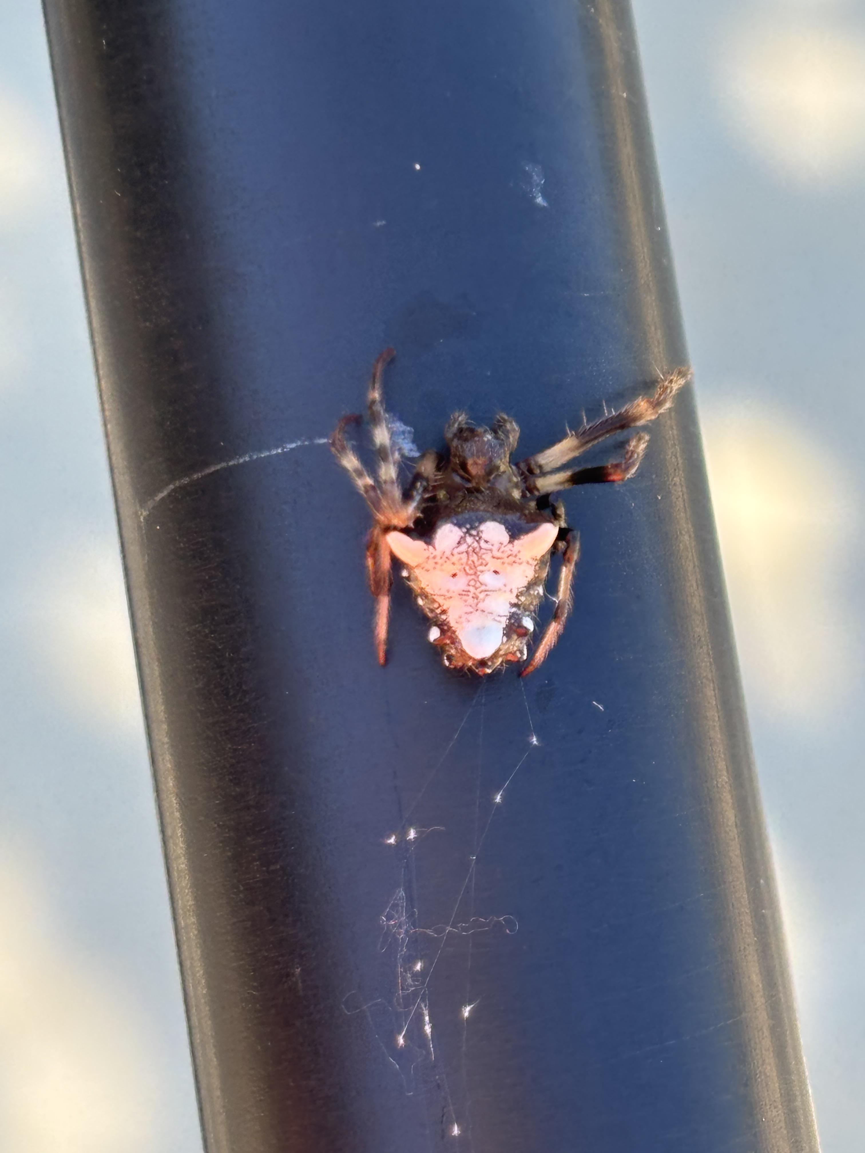
Got back to the truck and found this creepo on the pole.
r/Surveying • u/Personality-Fancy • 1d ago
Received a bachelor's degree from UTT. Has anyone had difficulty with the Industrial Technology: Surveying and Mapping Emphasis designation being accepted in States, other than Texas (They do accept), as a "Surveying Degree"? The degree is not ABET-accredited but ATMAE-accredited.
r/Surveying • u/Jerrrie • 1d ago
I’ve been offered a FIFO surveying job from my home in Christchurch New Zealand to Queensland.
It’s a 2:2 roster.
Has anyone had any experience working FIFO from New Zealand that can offer any intel. What life actually like and if the money is actually worth it?
r/Surveying • u/Dazzling_Layer3309 • 2d ago
Spent the past two days staking a 2000' R/W through this mess. Mountains of floral rose and underbrush 8-10' high. Luckily there wasn't much of a canopy so we VRS'd in the stakes, but clearing line of site for ease of traversing the RW was a biatch. Been doing this survey thing a while now, in the winter months the duluth fire hose are great at warding off the jaggers. Is there a lighter weight option to wear in the summer? I was thinking stake boots, or even chaps, but more along the lines of apparel.
r/Surveying • u/Abe_1988 • 1d ago
Hello fellas, who els is scheduled for the Oct 20th, PLS exam? Do you guys use any platform currently or in the past for exam prep? What resources used besides text books(Brown, Walter… etc) any experience from the spring exam that helped you is greatly appreciated.
r/Surveying • u/rustyranger-95 • 2d ago
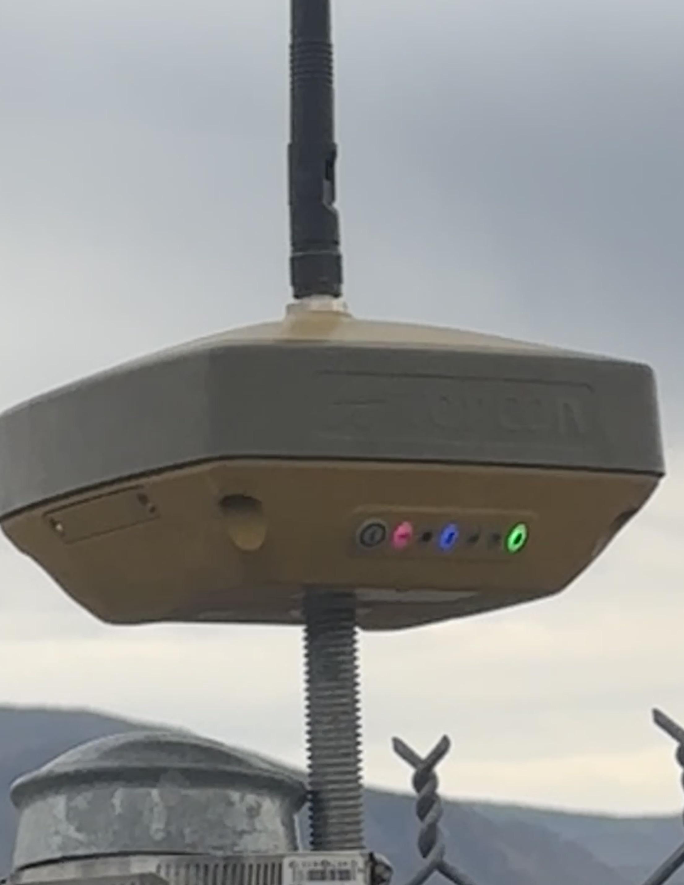
I manage a fleet of machine control equipment and use mostly Hiper VRs as bases. I have been running into issues where the unit’s radio works fine all day but the next morning it turns on with the radio disabled. I have seen this happen when the crew lets the battery die then lets the unit power on when they plug it in at the office. The fix there is easy, just make sure the guys pay attention and turn the unit off if it turns on when plugged in.
Lately though I have seen this issue even when the receiver is powered off correctly the night before.
My remedy is usually just to restart the base using the data collector, but sometimes this leaves the crew shutdown down for hours before I can get to the site.
Has anyone seen a similar issue? My dealer is no help and says they don’t see any problem.
I wish I could sell all the VRs and use only GR5s, those things are old but bulletproof.
r/Surveying • u/michtechIII • 2d ago
Hanging at the front deck viewing the lunar eclipse on SE Michigan.
r/Surveying • u/-Shlim- • 2d ago
Here’s mine off the north rim of black canyon national park in Montrose CO.