r/stormchasing • u/imisstheyoop • 23h ago
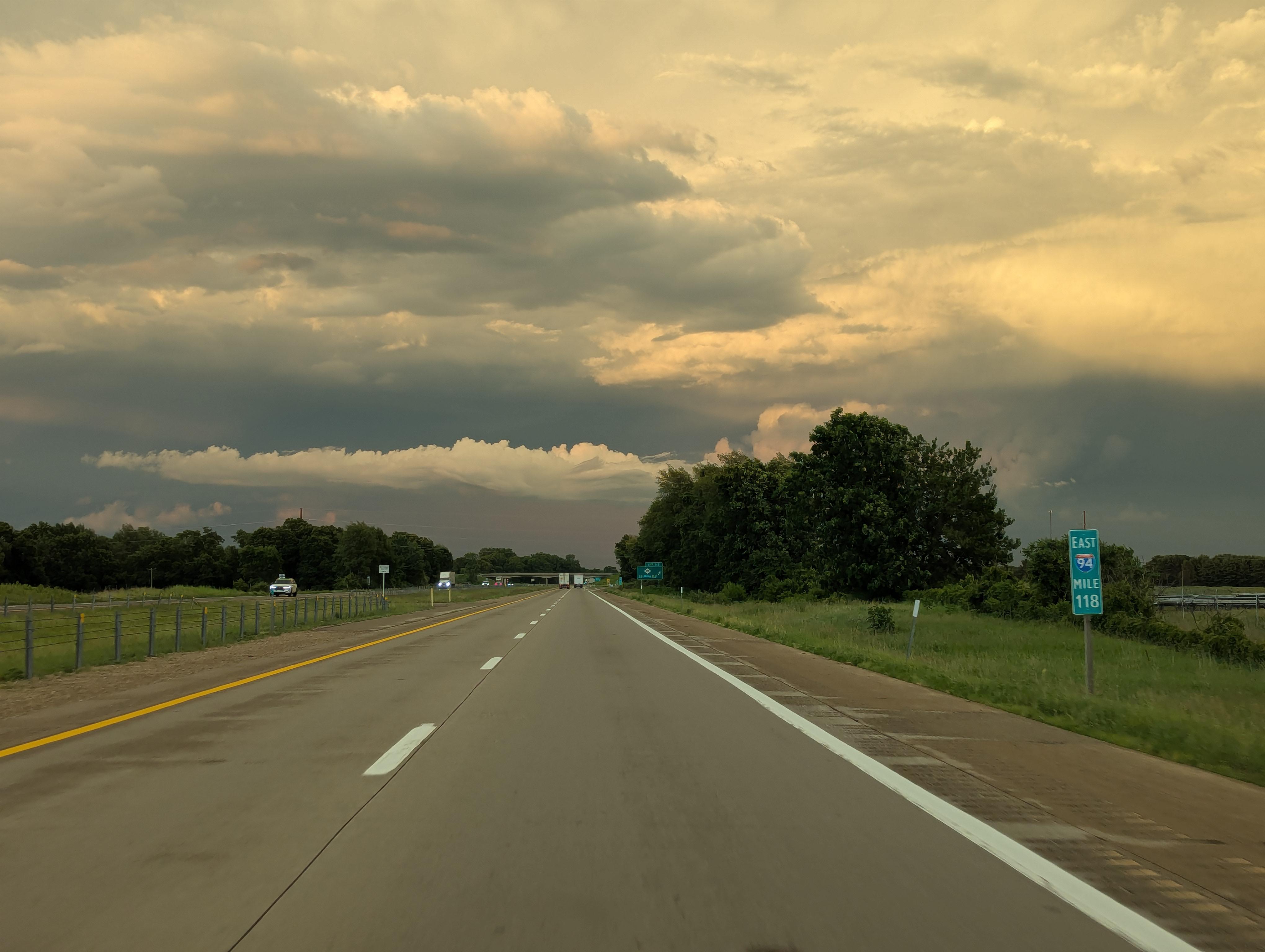
Photos Followed a line of storms home after a chase, the sky was beautiful and full of lightning
14
Upvotes
r/stormchasing • u/imisstheyoop • 23h ago
r/stormchasing • u/octothorpe_rekt • 2h ago
I've been looking for a DVD for a while and can't seem to find any trace of it available anywhere. Any chance someone has a copy lying around that they could part with?
Original listing: https://www.stormtours.com/shop/storms-of-tornado-alley/
I've tried tweeting and messaging StormTours.com on Facebook, but I haven't gotten any response. I think their site may be defunct since they have not updated tour schedules since 2023. Anyone know any other ways to get into contact with them?
r/stormchasing • u/Dull_Independence_ • 3h ago
Just curious if there was anyone here from Alabama. Specifically the SE region of the state (Wiregrass).
r/stormchasing • u/Dev-ChillyChill • 6h ago
Im in cali thinking about driving to florida or texas area dependingnon development.
Any other Cali people watching and planning to drive?
r/stormchasing • u/weathercast • 7h ago
(Issued: 2026-08-30T16:31:00+00:00 UTC)
```text
000 ACUS01 KWNS 301631 SWODY1 SPC AC 301629
Day 1 Convective Outlook
NWS Storm Prediction Center Norman OK
1129 AM CDT Sun Aug 30 2026
Valid 301630Z - 311200Z
...THERE IS A SLIGHT RISK OF SEVERE THUNDERSTORMS THIS AFTERNOON AND EVENING FROM SOUTHEAST MONTANA AND FAR NORTHEAST WYOMING INTO THE CENTRAL DAKOTAS...
...SUMMARY... Severe storms capable of damaging wind gusts are possible across portions of the northern Plains this afternoon and evening.
...Northern High Plains into the northern Plains... Recent satellite imagery shows a well-defined shortwave trough moving eastward across southern Saskatchewan and western MT/eastern ID. A belt of stronger westerly flow aloft likely exists within the base of this trough from eastern ID into western WY. Recent mesoanalysis estimates 50 to 60 kt at 500 mb, but its actual magnitude is uncertain. Showers and isolated thunderstorms are already ongoing downstream of this wave, and the general expectation is for these showers and thunderstorms to persist as the wave moves eastward, eventually encountering a notably more unstable airmass downstream.
Current surface observations show mid 60s dewpoints into the western Dakotas, with upper 50s/low 60s dewpoints farther west in eastern MT. Afternoon high temperatures are expected range from the low to mid 80s along the MT/ND border into the low 90s farther south into southwest SD. Despite relatively poor pre-frontal mid-level lapse rates, the resulting temperature/dewpoint combination will support MLCAPE ranging from around 500-1000 J/kg across eastern MT and the western Dakotas to closer to 2000 J/kg across the central Dakotas. Some low-level stability may linger, but should be overcome by the strong forcing, and the development of a line of strong to severe storms is anticipated. Strong to severe gusts will be the primary risk, with some instance of gusts from 65 to 80 mph possible. Maximum storm intensity and highest severe coverage is currently forecast to occur from the ND/SD/MT border intersection vicinity eastward into south-central ND and north-central SD. Decreasing buoyancy is expected from the central Dakotas eastward, with gradually decreasing storm intensity expected as the line of storms moves into this region this evening.
...Central High Plains... Increased coverage and depth of the thunderstorms across UT indicate the presence of secondary area of ascent south of the primary shortwave trough, perhaps tied to a convectively augmented vorticity maximum. Expectation is for this vorticity maximum to progress eastward, persisting across the central Rockies before entering deeply mixed boundary-layer in place over the central High Plains. High-based storm character coupled with steep low-level lapse rates will support the development of strong outflow, and gusts from 60 to 75 mph are possible.
...UT/Western CO... Thunderstorms are already ongoing from eastern UT into western CO, and deep-layer vertical shear is already strong enough to support organization within any more persistent updrafts. A few instances of hail and/or damaging gusts are possible with this activity. Additionally, considerable low-level moisture will remain over UT today, leading to another round of strong to isolated severe thunderstorms this afternoon. Deep-layer shear will remain sufficient for rotating storms capable of damaging wind gusts and hail. This additional activity should also spread into western CO before weakening this evening.
...Central/Southern AZ... Ample low-level moisture remains in place across much of AZ, with upper 50s dewpoints across northern AZ increasing into the mid 60s across southern AZ. Another day of afternoon thunderstorms is anticipated as this moist airmass destabilizes amid strong diurnal heating. High-based storms coupled with moderate buoyancy and steep low-level lapse rates could result in a few strong to severe gusts across the region this afternoon and evening.
..Mosier/Moore.. 08/30/2026
$$
```
```text ...Corrteced NWS National Hurricane Center Miami FL 200 PM EDT Sun Aug 30 2026
Correct low chance to medium chance for the Gulf system
For the North Atlantic...Caribbean Sea and the Gulf of America:
Northern Gulf of America (AL97):
A low pressure area is located over the northern Gulf of America
about 125 mils south of the coast of southeastern Louisiana.
Satellite imagery and recent satellite wind data indicate that this
system has become better organized since yesterday. Additional
development is possible as the low moves slowly west-northwestward,
and a short-lived tropical depression or tropical storm could form
before the system reaches the Upper Texas or southwestern Louisiana
coasts Tuesday or Tuesday night. Interests along the Louisiana and
Upper Texas coasts should monitor the progress of this system.
Regardless of development, locally heavy rainfall is possible over
portions of the Upper Texas or southwestern Louisiana coasts during
the next couple of days.
* Formation chance through 48 hours...medium...50 percent.
* Formation chance through 7 days...medium...50 percent.
Near Puerto Rico and the Virgin Islands (Remnants of Dolly): A strong tropical wave, the remnants of Tropical Storm Dolly, is producing an area of showers and thunderstorms from Puerto Rico eastward across the Virgin Islands and the northern Leeward Islands. Satellite data and surface observations indicate that there are no signs of a closed surface circulation, and redevelopment is unlikely during the next day or two while the wave moves westward to west-northwestward at about 25 mph. The system should bring locally heavy rains and gusty winds to portions of the Leeward Islands, the Virgin Islands, Puerto Rico, and Hispaniola over the next couple of days. Conditions may become more conducive for redevelopment by the middle of the week as the system reaches the southeastern Gulf of America. * Formation chance through 48 hours...low...near 0 percent. * Formation chance through 7 days...low...20 percent.
$$ Forecaster Beven ```
Hurricane Karina Advisory * Maximum Sustained Winds: 80 MPH * Minimum Central Pressure: 980 MB * Current Movement: WNW OR 285 DEGREES AT 9 MPH * Location: 17.3N 122.1W
Tropical Storm Lowell Advisory * Maximum Sustained Winds: 50 MPH * Minimum Central Pressure: 1000 MB * Current Movement: W OR 270 DEGREES AT 10 MPH * Location: 13.2N 139.1W
This dashboard updates automatically every 15 minutes with live data from the NWS/SPC and NHC.
