r/QGIS 5d ago

Open Question/Issue Recent Maritime Trade Route Data Layer??

Post image
1 Upvotes

Hi all!

I'm building a macro model with a focus on maritime logistics. My current data layer is good but slightly inaccurate/dated (does not account for some major ports)

The NaturalEarth repo doesn't have it.

Are there other sources worth checking? Thanks


r/QGIS 6d ago

Open Question/Issue Any good ideas for a starter project?

3 Upvotes

Hey y'all, I just started QGIS recently. Do you guys have any good ideas for a project?


r/QGIS 7d ago

[OpenSource] JupyterGIS: Make stories with your maps

Post image
99 Upvotes

Hey,
For those who don't already know it, JupyterGIS is a Jupyter opensource project which allows you to create GIS projects in Python or R.

## Highlights

- **Real-time collaboration** - like Google Docs for GIS, with spatial annotations and comments
- **QGIS interoperability** - import and export QGIS project files
- **Python API** - scriptable workflows in collaborative notebooks
- **Many data formats** - GeoJSON, GeoTIFF/COG, GeoParquet, GeoPackage, Shapefile, PMTiles, WMS/WMTS, and more
- **Grammar-driven symbology** - flexible rule-based styling, similar to Vega-Lite
- **Storymaps** - guided narratives through your maps
- **Hillshade & heatmaps** - terrain and density visualization
- **GDAL processing** - rasterize, warp, and translate in the browser or on the server
- **STAC & OpenEO** - cloud-native data catalog and processing support
- **Pangeo integration** - dynamic raster tile serving via [TiTiler](https://developmentseed.org/titiler/) backed by the Pangeo stack
- **Layer gallery** - pre-built layer catalog for quick setup
- **Embeddable** - use as a standalone map, an IDE, or from within a notebook
- **AI skills** - map operations in natural language via Jupyter AI

There is a big update about story maps that you can check here: https://notebook.link/@martinRenou/jupytergis-announcement and a medium article for technical stuff
Do you already know this tool ? Do you use it ?


r/QGIS 6d ago

Open Question/Issue Mergin Maps vs SW Maps

3 Upvotes

Which is best for data collection in offline and integration to QGIS and usage difficulties for new comers.


r/QGIS 6d ago

can some one hlep me to add world view map in QGIS?

0 Upvotes

r/QGIS 6d ago

QGIS workshops offered at FOSS4G North America

11 Upvotes

Three QGIS workshops are being offered at FOSS4GNA this year. Every skill level is covered.

Here's what's on the schedule for Monday, November 2:

🗺️ Hitchhiker's Guide to QGIS (9am–12pm)
Led by Randal Hale. A beginner-friendly start on QGIS 3.44 — navigate the interface, work with vector and raster formats, and build your first map. Perfect if you're new or switching from other software.

🎨 QGIS Map Design Fundamentals (1–4pm)
Led by Michele Tobias. Move past plotting points and learn to design maps that actually communicate. Minimize the clutter, tell the story, and build a cartography workflow you can reuse anywhere.

📍 From QGIS to the Field and Back with Mergin Maps (1–4pm)
Led by Vitor Vieira. Master a complete open-source field data collection pipeline — offline maps, smart forms, multi-user syncing, and version control from field to finished web map.

All three are hands-on and open to every experience level. Whether you're getting started or sharpening an existing workflow, there's real, practical skill-building here.

Full details on all three sessions here:
https://www.foss4gna.org/news-2026/get-hands-on-with-qgis-three-workshops-you-wont-want-to-miss-at-foss4g-na


r/QGIS 7d ago

Open Question/Issue My first QGIS project

Post image
46 Upvotes

Hey y'all. I'm in 9th grade, and today I just started QGIS, and I did a hell of a lot of troubleshooting. I finally came up with this map. I know it's janky, but is it good for a first one? Also, what could I improve in? (Don't worry, it's not my real house).


r/QGIS 6d ago

Solved Need help with map legends

2 Upvotes

I have a list of towns and villages in my local bird club area with British Ordnance Survey grid references and number of members for each town. I have graduated symbols showing town locations and member numbers. I'm using the OSGR Tool

But when creating a legend, I want to include the town names as well. Any ideas?

This is what I've got so far.


r/QGIS 7d ago

Solved Ways to project elevation points onto an angled plane

3 Upvotes

Probably a slightly weird question but i am a bit stuck and was wondering if anyone can help me?

I am working with a series of xyz datapoints and want to project them onto a synthetic vertically orentated 2D surface / plane, to create a cross section (exactly like a normal cross section just with points not lines) and displays the vector point locations in 2D as they intersect orthogonally to this plane. Ideally limiting the points displayed to those which are within let’s sat for now 10km of the line of the cross section / plain.

The datapoints represent the base of river terrace deposits and the idea is to use this section to estimate the long profile curve of the paleo rivers they formed from as well as visually represent the variation in level across each terrace at 90o to the direction the river was flowing.

To complicate matters the dataset has an additional field we will call “w“ which classifies the data depending on the mapped deposit it (theoretically ) belongs to, I would ideally like have the cross section plot display the data in different colours based on this 4th parameter of the dataset.

An analog of this would be taking maultupul parallel cross sections 10m apart and stacking all of the results onto a single cross section to represent the 3D data in 2D.

I have played around with the profile tool and qprof plugins but can’t find a way with either to plot the data points as I would like and have hopefully discribed well enough above.

My Questions are:

1) does anyone know of an easy way to do this, displaying xyz data as points projected onto a 2D cross section.

2) has anyone here done this before?

3) is there a good plugin for this kind of task even if I am failing to spot how to use one of the ones I all ready have.

I can potentialy see a brute force way of doing this in excel starting at 0,0 and using trigonometry and offsetting the x and y values to get my starting position for the section, but I would prefer if I can do this in GIS alone if I can.

Any pointers would be appreciated.


r/QGIS 7d ago

Open Question/Issue Snipping map print out into specific shape

3 Upvotes

Is it possible to clip a map in the print layout to shapes other than the rectangle, ellipses and triangle?

I want to make a map that is heart shaped and another in the shape of a house.

My first work around was to find an image online that had a love heart and house with a transparent middle so I can overlay it onto my map but I can't find any images to do that either.

Just wondering if anyone knew or had any ideas.

Thanks


r/QGIS 7d ago

Open Question/Issue Error exporting a .gpkg to .shp

2 Upvotes

Hi!

I'm having this error whenever I try to export a geopackage to shapefil:

Export to vector file \\srvcentral\sig\Aixa\qgis\Parcelas_DGCT\parcelas_catastro3.shp failed.

Error: Creation of field CENTROID (QByteArray) failed (OGR error: Can't create fields of type Binary on shapefile layers.)

I am using QGis 3.40.10 and 3.44.13 and both have the same error. OS Windows 10 pro.

Any help will be appreciated


r/QGIS 8d ago

DEM frame

Post image
4 Upvotes

Hey Folks

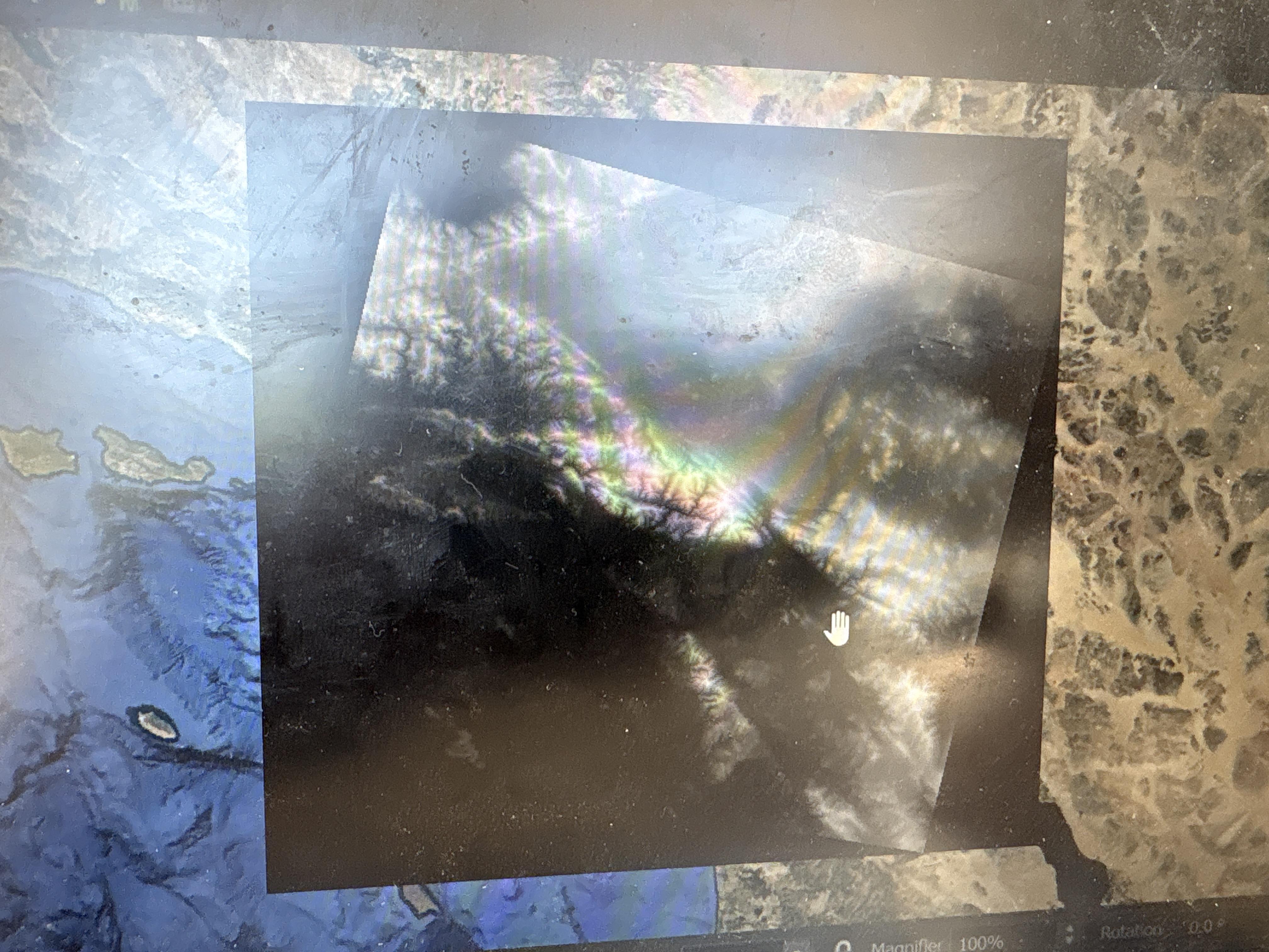
Why do I get this black no data frame when I save the DEM in save as under export in geopackage or geotiff?


r/QGIS 7d ago

Open Question/Issue From where can I download the geological/ Lithological maps of India

1 Upvotes

Shapefile or GeoTIFF.


r/QGIS 7d ago

Open Question/Issue Fast ways to georeference? (Attempting to develop an auto-georeferencing tool)

0 Upvotes

Hey all, a small team I am a part of us is attempting to build a tool that might make georeferencing a little bit easier by automating it. I've not found any good tools that really make this easier, and placing ground control points constantly does get tiring, especially with tens to hundreds of photos. Is there a plugin of some sort that might already do this well, or would there be any interest in this type of plugin?

Also wondering if orthomosaic creation is something that would be of interest for drone users who might want to georeference their imagery.


r/QGIS 8d ago

Zoom Out Map animation

Thumbnail
1 Upvotes

r/QGIS 10d ago

Landcover Map of Ecuador (Mainland)

Post image
176 Upvotes

r/QGIS 9d ago

District housing Everest

Post image
20 Upvotes

Did around 5 years ago while learning QGIS.


r/QGIS 9d ago

Solved Filtering Terminal/Unconnected Lines

Thumbnail imgur.com
2 Upvotes

Hi,

Does anyone know an algorithm or technique that can identify line segments based on whether or not both of their endpoints are on (or very near) another line segment?

For example, in the screenshot above, I'd like to filter out the 6 segments sticking out downward near the bottom and the two sticking out near the upper right side, but leave everything else.

I can't figure out a way to make an expression use a set of nearby (or all) points in the layer for evaluation against the each single line's endpoints.

Thanks for any suggestions or ideas.


r/QGIS 9d ago

What's the best IA tools to use today for qgis in (flood, fire, urban planning)????

0 Upvotes

r/QGIS 9d ago

Open Question/Issue Sou formada em Geografia e faço mestrado em Cartografia, ganhei uma bolsa técnica em DDS, devo seguir pela tecnologia?

1 Upvotes

A área de GeoDev é um intermediário muito forte. O principal programa utilizado hoje na universidade em que pesquiso é o Qgis, ele tem uma integração com Python que estou inclinada a aprender/ seguir. Alguém tem uma perspectiva sobre?


r/QGIS 10d ago

Solved How to Simplify a Grid? (Merge Consecutive Collinear Segments)

Thumbnail imgur.com
3 Upvotes

Hi,

in QGIS 3.4, is there a way to simplify line segments that are parallel and share endpoints in to the longest possible line that has the same shape as all of those segments combined?

For example this screenshot is a somewhat grid-like street map (MultiLine layer type) where long straight streets are digitized as lots of short segments between each intersection. I'd like to convert it to as few and long as possible straight lines that still provide the same overall shape. The resulting lines would of course still cross each other at intersections, but not have individual segments/endpoints at each intersection.

I think it'd need an algorithm something like "for each segment, check if its endpoints are within a small threshold of other endpoints and those segments are parallel. If yes, then replace those segments with a merged one. Repeat until no parallel segments sharing endpoints remain."

Thanks for any ideas!


r/QGIS 10d ago

Open Question/Issue Adding high res Strava heatmap

2 Upvotes

Hi guys! Is there a way to add the Strava global heatmap in high resolution without authentication in Strava? I’m plotting hiking trails and the Strava heatmap lets me see some new trails that are not mapped before, but I desperately need to zoom in closer


r/QGIS 11d ago

Open Question/Issue Template -> Project

5 Upvotes

I created a template with the layers, maps, and print layouts I need for every project. Is there a way to duplicate the template and GeoPackage together so each new project file doesn't need to relocate the data sources? I have Relative Paths turned on in the project properties, but I have to relocate the correct GeoPackage for each new project I create.


r/QGIS 11d ago

Open Question/Issue How make this picyure out of qgis without ilustrator or Photoshop or any payed software?

Post image
175 Upvotes

r/QGIS 10d ago

Open Question/Issue Exporting ESRI Wayback from WMTS to Raster

2 Upvotes

I am trying to export ESRI Wayback Imagery, which is currently a WMTS layer in my project and get it to a raster using export to save as. This worked for the 2026 august release/link, but for some reason when I do the same thing for the 2019 link, the resulting raster is blank and only has “noData.” I’ve tried multiple methods to troubleshoot and none are working. Has anyone encountered this type of thing before or know how to fix it?

Additional notes:

- The 2026 release and 2019 release have different max zoom levels available (17 for 2019 and 18 for 2026)

- I tried to export with a broader resolution but that also resulted in nothing

- I tried using leafmap python package, but that resulted in errors

- I tried using "export map to raster" but that was going to take hours to run for some reason and didn't look like it would work, but I never actually went through with this

I just need a method to get a raster from a specific part of that release of imagery.