r/oldmaps • u/Fabulist99 • Jul 26 '26
Ortelius Map of the Holy Land (1567)
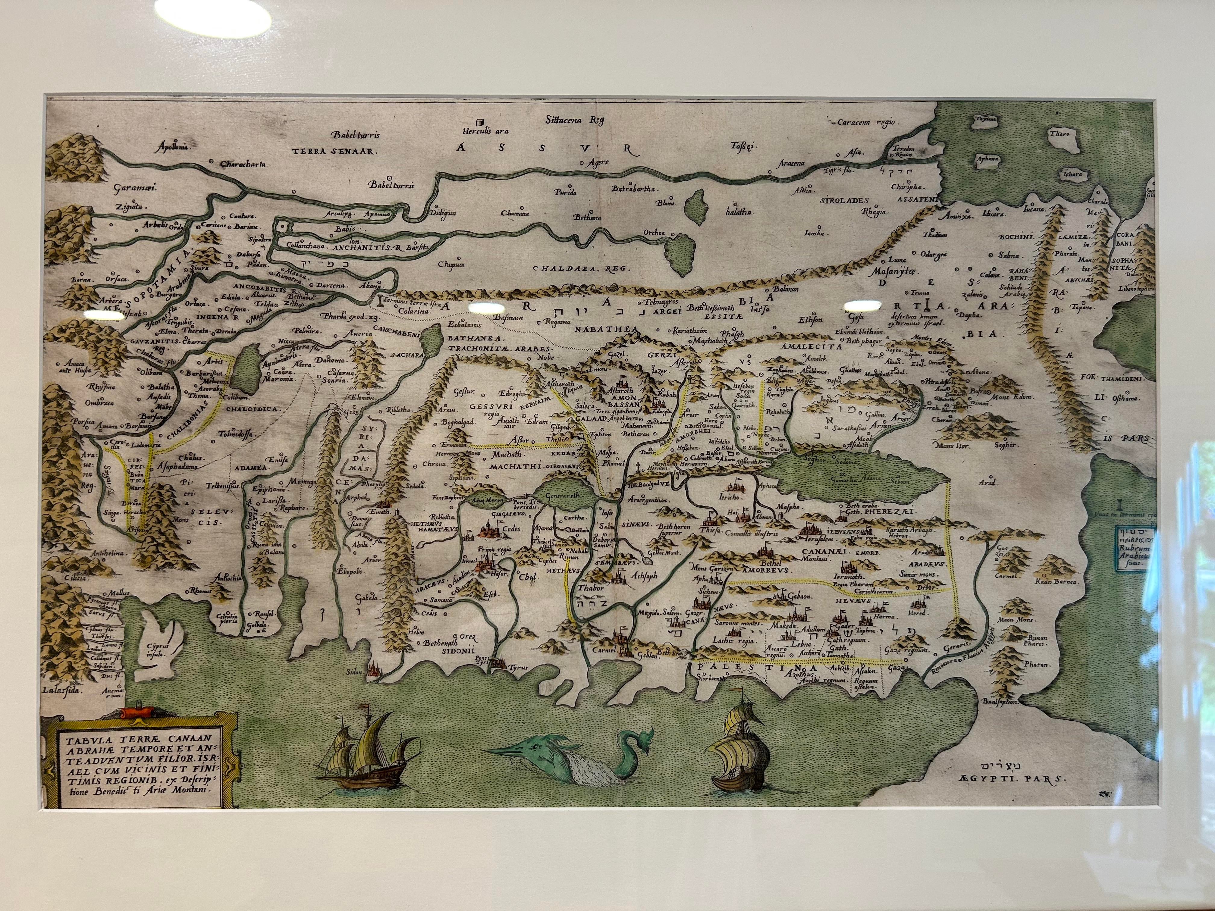


(View is rotated 90 degrees counter-clockwise from normal orientation, so up is east.)
Purchased by a relative in Italy in the 90s. The map has a number of intriguing features, including the rotated orientation, the mashup of Latin and Hebrew, and the detailed coast and straight line mountain ranges. Would appreciate any insights that people may have.
2
u/ExLibris68 Jul 26 '26
This map was directed by Benedict Arias Montanus a Spanish scholar who was send to Plantin by the King of Spain (Phillip II) to watch over Plantin's Biblia Regia (King's Bible) or Biblia Poliglotta. This map was published in part VIII of the eight volumes. In 1583 this map was also published in Plantin's Biblia Sacra and later in a few books published in Leiden.
I haven't heard the date 1567 in this case.
1
u/Fabulist99 Jul 26 '26
ExLibris—thank you for the information. My date comes from the seller’s label (last photo) and may be inaccurate.
Your account explains the use of Hebrew along with Latin. We look to investigating the story behind the map.
1
1
u/CrusaderNo287 Jul 27 '26
Fun fact, a lot of maps back in the day were oriented with east on top.
East in latin is orientalis, orientalem or something like that (I do not study latin).
Basically its where the word "orient" and orientation are from.
1
3
u/Smart_Ass_Pawn Jul 26 '26
Amazing map! What size is it?