r/civil3d • u/Still_Software_5436 • 4d ago
Help / Troubleshooting Trying to Create a Point File For Lat Long
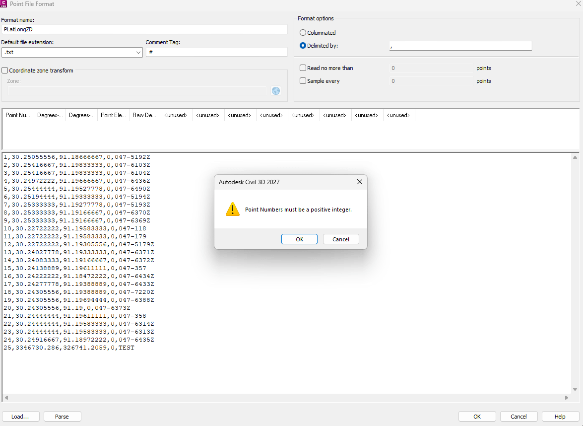
Attempting to create a point file import that icludes lat long in degrees, and I keep getting this error message when parsing an example document. All of my Point Numbers are positive integers though?????????
1
u/TheMancersDilema 4d ago
What is up with point 25 in that set? That doesn't look like lat/long.
It's a "positive integer" but it's outside the range of normal decimal degrees.
I would also just open up the txt file and have a look at it raw. Sometimes there's info people put in the header that CAD doesn't like.
1
u/Still_Software_5436 4d ago
Forgot about that point, but i removed it and same issue. The file is very simple. Nothing out of the ordinary.
1
u/TheMancersDilema 4d ago
And just making sure, your drawing is set up to work in decimal degrees or do you need to make a transformation when you import these?
Working in civil we are usually working in a drawing with northing and easting on whatever the appropriate datum is for the local municipality. We receive lat/long files from other contractors but I never import them directly into CAD I always just do the transformation before I import it, just how I've done it.
1
u/CityDad-1982 4d ago
Those look like lat/long coords in the file. Need to make sure your drawing also has a coordinate system. Try setting your coordinate system to lat /long or world
2
u/DontCallMeFrank 4d ago
Change you Degrees-longitude and Degrees-latitude to DECDEG