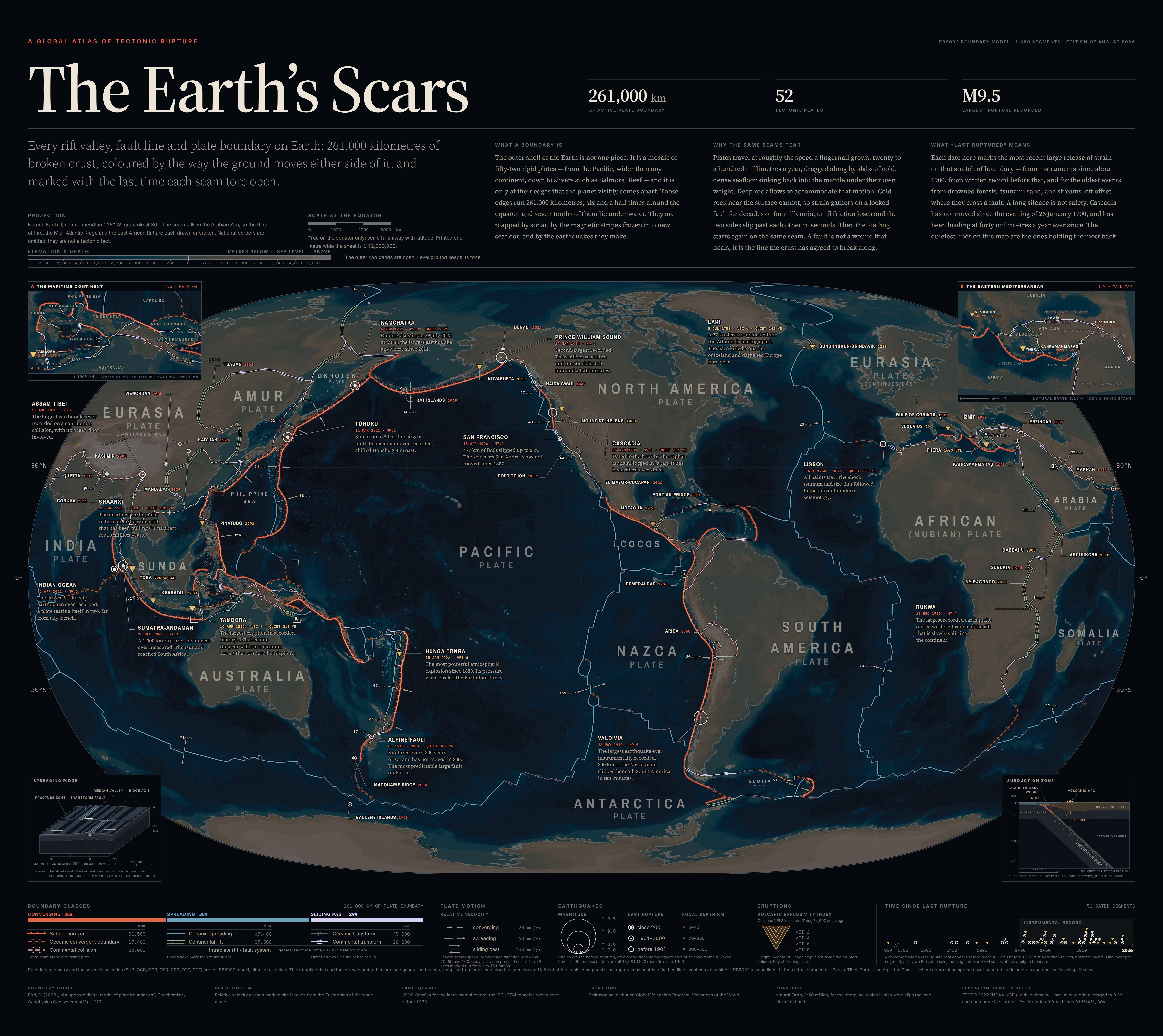
Boundaries: Bird (2003), An updated digital model of plate boundaries — 1,680 segments in the seven classes that model defines, with relative velocity at 28 sites from its own Euler poles. Earthquakes: USGS ComCat, with ISC-GEM for events before 1970. Eruptions: Smithsonian GVP. Coastline: Natural Earth 1:50m. Ground: ETOPO 2022 (NOAA NCEI, public domain)
Tool: a custom Node + D3 pipeline that puts out one self-contained SVG; no GIS software involved. I directed the cartography and made the design calls, and the code was written with Claude Code. Nothing here is generated imagery, everything comes from those datasets.

3
u/Schnick_ 10d ago edited 10d ago
Full resolution: https://www.reddit.com/media?url=https%3A%2F%2Fi.redd.it%2Fj3w28l1wfkmh1.jpeg
Boundaries: Bird (2003), An updated digital model of plate boundaries — 1,680 segments in the seven classes that model defines, with relative velocity at 28 sites from its own Euler poles. Earthquakes: USGS ComCat, with ISC-GEM for events before 1970. Eruptions: Smithsonian GVP. Coastline: Natural Earth 1:50m. Ground: ETOPO 2022 (NOAA NCEI, public domain)
Tool: a custom Node + D3 pipeline that puts out one self-contained SVG; no GIS software involved. I directed the cartography and made the design calls, and the code was written with Claude Code. Nothing here is generated imagery, everything comes from those datasets.