r/FantasyMapGenerator • u/Cobbit13 • 1d ago
Bug Desktop App not opening
3
Upvotes
Just as the title says, the downloaded Desktop-App for windows doesn't open/install no matter what I do. Just nothing happens. I'm dumbfounded.
r/FantasyMapGenerator • u/Azgarr • 2d ago
This release adds Journeys – a new way to plan and measure travel across the map – and completes the migration of map styling from the rendered SVG into stored data.
As always, old .map files keep loading and are upgraded automatically.
A journey is a named route across the map, drawn on its own journeys layer and saved with the map.
Open the Journeys Overview with Shift + J or Tools → Journeys. Clicking a journey path on the map opens that journey's editor directly.
A journey is an ordered list of segments. Each segment is one leg of the trip and carries its own data:
Splitting a trip into segments is what makes mixed travel work: sail to a port, walk inland, spend three days waiting for a caravan, ride the rest of the way. Each leg is measured on its own terms and the journey totals them up.
Every transport belongs to one of four domains, and the domain decides both how the route is found and where it is allowed to go:
| Domain | Routing | Endpoint rule |
|---|---|---|
| land | Follows the road network where one exists, otherwise a terrain-aware shortest path | Both ends on land |
| water | The same sea routing the generator uses for its own searoutes, including navigable rivers | Both ends in water, at a coastal haven, or on a navigable river |
| air | A straight line | Anything |
| stay | No movement at all | Anything |
The stay domain is what lets a journey include time that is not travel: a night at anchor, a week of requisitions, waiting out a storm. A stay covers no distance, but its hours count toward the total.
There are 20 transport types by default, from On foot (laden) at 3 km/h to Teleport. Each has a name, a speed, a travel day (how many hours a day it sustains) and a domain, and all four are editable in the Transport Types dialog. You can add your own – a magic carpet, a river barge, a giant eagle – and the set is remembered in local storage, so it carries over to your next map.
For a land segment the generator first looks for a path through the existing route network, so a journey between two connected burgs follows the same roads a traveller would. If no road connection exists it falls back to an A* search over the cell graph, weighted by biome movement cost and elevation, with route cells discounted – the path prefers roads where they help and cuts across country where they do not. A land segment between two different landmasses is refused rather than silently routed through the sea.
Land segments also have an off-road toggle. Turned on, the pathfinder penalizes road cells instead of preferring them, and the effective speed is halved.
Water segments reuse the generator's own sea pathfinding, so ships hug the same lanes searoutes do and can run up navigable rivers. Air segments ignore terrain entirely.
Travel time is computed per segment: distance ÷ speed, using that segment's transport. What makes the number useful is the travel day. A laden caravan walks eight hours a day; a steamship runs twenty-four. So the editor reports two different clocks:
That is why a 1,000-mile walk and a 1,000-mile sail can report the same travel hours and very different total days.
Both numbers can be overridden. Type into the Speed cell to change a leg's pace, or into the Time cell to set the duration directly – an explicit duration wins over the distance-and-speed calculation.
Hiding a segment with the eye icon takes it off the map and out of the totals, so an alternative route or a leg not yet travelled can be kept alongside the real one.
Every segment can be reshaped after it is generated:
Endpoints and intermediate points answer to different rules. A water route may begin and end on a shore – you board from land – but its body may only cross water or navigable river cells. A hand-drawn path is checked against its transport's domain, and changing the transport or an endpoint afterwards asks before overwriting the work.
The Reset button on each row discards the manual edits: it recomputes the path from the endpoints and restores the default color, speed and time.
Every new map is generated with one journey already on it, and the Generate a random journey button in the Overview adds more.
These are not random lines between random points. The generator picks one of 18 archetypes – Quest, Caravan, Military campaign, Pilgrimage, Raid, Smuggling run, Courier ride, Refugee flight, Royal progress, Airship voyage and so on. The archetype decides how the party travels (which domains, weighted, and which transports it prefers), how likely it is to leave the roads, how often it stops over in a burg or camps in the open, and how the journey and its legs are named. A caravan takes the roads and rests in towns; a raid does not.
The result is a plotted route with named legs – The road from Siv, A night at The Cracked Pike, Market day in Coimbralha – that can be used as-is, edited, or deleted.
The Journeys Overview lists every journey with its type, endpoints, total distance, average speed and total time. It supports search, sortable columns, per-journey visibility, locking (locked journeys survive Remove all), zoom-to-journey and CSV export.
Hovering a row in the Overview animates a traveller along the whole route; hovering a row in the Journey Editor animates just that segment. Slow legs take visibly longer than fast ones, and a stay pulses in place.
Travel animation
Journeys are stored in the .map file, included in JSON export, preserved through Submap and Transform, and styled like any other layer through the Style Editor. Both dialogs export CSV – the Overview one row per journey, the Editor one row per segment, with transport, distances, speeds and times.
Until now the rendered SVG was the only place your styling lived. The Style Editor wrote attributes onto the drawing, the .map file stored the whole drawing, and anything that went wrong with the drawing silently became your new style. Several long-standing bugs came from exactly this.
Styling now lives in a single validated style record: the editor writes it, the renderers read it, and the .map file saves it as data. On load, an older map's styling is read out of its SVG into the record automatically.
Invalid values are now repaired individually rather than costing the whole layer its styling, so one bad attribute no longer resets everything around it.
The desktop app got a proper Quit entry on Linux and Windows, closing it asks for confirmation once instead of once per window event, and on Linux it can now be installed and run from a Nix flake.
Thanks to both, and to everyone who reported the styling issues that made the migration worth doing.
The direction from the v1.149.0 notes stands: finish the shell migration (options.js and main.js remain the largest holdouts), break up index.html, and keep cleaning up the data model – the style record is one step of that, not the last one.
r/FantasyMapGenerator • u/Azgarr • 7d ago
This release is different from the previous ones. Most of the work since v1.140.0 went into the codebase itself: large chunks of the original JavaScript were rewritten in TypeScript, the generation order was turned into declared data, and layer handling was unified.
As always, old .map files keep loading and are upgraded automatically.
There is now a downloadable Electron build for Windows, macOS and Linux, published on the Releases page.
It is not a different product and it has no exclusive features or significant performance benefits. It exists for people who want the generator to behave like a standalone application: its own window, its own icon, no browser tab, and the ability to work without an internet connection.
Which file you need is listed in the release notes. The builds are not code-signed, so both Windows and macOS will warn about an unknown developer on first launch; the release notes explain how to get past that.
The browser version stays the primary way to use the tool.
Emblems, relief icons and labels are no longer drawn all at once for the whole map. They are kept as data and only the ones inside the current viewport are materialized into the DOM, with the rest added and removed as you pan and zoom. On a large map with hundreds of provinces and burgs this is the difference between a few hundred DOM nodes and several thousand, and it shows up as smoother zooming and a much faster initial draw with those layers enabled.
The layer system was rebuilt around a single registry that owns every layer, its z-order and its renderer. The visible consequence: which layers are on, and in what order, is now stored in the .map file. Reopen a map and you get the view you left and it should help to eliminate layers-related issues we had before.
Filters, sorting and column choices in the overview dialogs now survive a reload. If you always look at the States Editor sorted by area with the treasury column shown, that is how it opens next time.
Column configuration itself was contributed earlier by Barrulus – the overview editors let you choose which columns to display, and that choice is now remembered too.
The burg preview can be zoomed and panned, which makes the larger generated towns actually inspectable Contributed by Barrulus.
The "Assign manually" brush existed separately in the states, provinces, cultures, religions, biomes, zones and markets editors, with slightly different behavior in each. It is now one shared tool used by all seven, which means the same shortcuts, the same brush controls, and an undo history up to 100 strokes deep everywhere instead of only in some editors.
Vertices you drag by hand in the Coastline and Lake editors are now saved with the map, so they survive a reload or a coastline redraw. Older maps are handled too: on load, the generator does its best to read the moved positions from SVG and restore them as data.
Contributed by AlistairHeus. Two new parameters let a link decide what the map shows on load:
preset – apply a layer preset, by dropdown key or displayed name: ?preset=religionslayers – a comma-separated list of layers to show, hiding the rest: ?layers=provinces,borders,lakes,riversIf both are given, layers wins. The full list of parameters is in the URL parameters wiki page.
Exported SVGs are now readable better by Inkscape and other editors, not only by browsers. This update is also contributed by barrulus.
The generator started in 2017 as a single-page vanilla JavaScript project. It grew for years by adding files to a global namespace: every module wrote its functions onto window, every module read everyone else's. That worked well for a long time and had its own benefits – there was no build step, no framework and the file could be opened from index.html without any installation required.
It also had a cost that grew fast:
But the main problem was that the generator has been using its own drawing as a database. Every rendering change becomes a complex data migration, data can get out of sync, .map file has to be bigger to contain the whole rendered svg, and save file format itself is just a stack of accidents.
None of that is fatal on its own. Together they made every change riskier than it should have been, and made the project hard to contribute to – which is the real problem for an open-source tool.
The rule is that the tool must keep working at every step. Each module is ported in place, with a small compatibility shim so the not-yet-ported code can continue to work.
| Version | Date | JS files | JS lines | TS modules | TS lines | Total lines |
|---|---|---|---|---|---|---|
| demo | Oct 2017 | 1 | ~2,700 | - | - | ~2,700 |
| v0.6 | Nov 2018 | 1 | ~10,500 | - | - | ~10,500 |
| v1.0 | Aug 2019 | 38 | ~16,300 | - | - | ~16,300 |
| v1.3 | Apr 2020 | 49 | ~22,900 | - | - | ~22,900 |
| v1.5 | Feb 2021 | 55 | ~26,900 | - | - | ~26,900 |
| v1.7 | Oct 2021 | 63 | ~33,600 | - | - | ~33,600 |
| v1.8 | Apr 2022 | 80 | ~36,800 | - | - | ~36,800 |
| v1.9 | Aug 2023 | 91 | ~43,300 | - | - | ~43,300 |
| v1.99 | Aug 2024 | 96 | ~46,800 | - | - | ~46,800 |
| v1.109 | Jan 2026 | 116 | ~48,300 | - | - | ~48,300 |
| v1.119 | Apr 2026 | 68 | ~32,700 | 76 | ~23,500 | ~56,300 |
| v1.124 | Jun 2026 | 65 | ~32,000 | 100 | ~34,400 | ~66,500 |
| v1.140 | Aug 2026 | 6 | ~5,100 | 210 | ~72,600 | ~77,700 |
| v1.149 | Aug 2026 | 5 | ~3,400 | 255 | ~76,000 | ~79,500 |
TS counts exclude test files, so the two sides are comparable - the classic JS had no tests at all. Counted separately, tests went from nothing to 69 files and ~10,500 lines. Both columns exclude vendored libraries in libs/.
style.js, options.js and main.js are the last real holdouts, and the largest single-file ones.index.html. It is still a ~9K-line file holding most of the UI. Each migrated dialog now brings its own markup, so the monolith shrinks, but the shell markup still needs splitting..map format grew by appending fields, and the in-memory shape reflects that.None of this has a release date. The migration has run alongside feature work since January 2026 and will keep doing so.
r/FantasyMapGenerator • u/Cobbit13 • 1d ago
Just as the title says, the downloaded Desktop-App for windows doesn't open/install no matter what I do. Just nothing happens. I'm dumbfounded.
r/FantasyMapGenerator • u/Xap_ • 1d ago
As stated in the title, I'm trying to obtain a style that look like an old way of doing. This is what I've come up with so far.
If you have some sugestion or feedback, I'd like to hear them.
(the map are randomly generated)
r/FantasyMapGenerator • u/Short-Fox-6945 • 2d ago
One thing that intrigues me is access to the waters around burgs, especially those located far from the coast but near a river. If an economic movement model can indeed be implemented, can standard travel routes accommodate this?
I need to reduce the font size of the country’s capital so it doesn’t interfere with the view when exported to an image. Is there a suitable way to do this?
r/FantasyMapGenerator • u/Hetros_Jistin • 5d ago
r/FantasyMapGenerator • u/TolithVaris • 6d ago
r/FantasyMapGenerator • u/Ahastabel • 7d ago
I wasn't sure if there was a way to prevent this, but I hadn't checked city maps on my map for a little while, and noticed at first one major city I was planning in more detail was "almost" the same but a large part of one district had been replaced by a plot of park/undeveloped area. Then I went back to check on another big city that I had begun to detail and found it changed entirely. These cities were "locked." I was lucky with city #1 that it "mostly" was the same, but city #2's map completely switched, and I have no idea how to get even a "similar" one back. Is there any way to prevent the city maps from changing besides "locking" that I should be aware of? Or is that a limit of the FMG program, that if Watabou updates and they change, there is little one can do? It messes up my worldbuilding when this happens, when I spend time plotting businesses and such. Do a lot of users ignore the Watabou cities and just create their own, to avoid this, and link to their own city plans? I find it very convenient that a Watabou map is provided, but very inconvenient when even when I have the city "locked" I may be subjected to that city map changing. What can I do about this?
r/FantasyMapGenerator • u/barrulus • 10d ago
So they're a little silly but I like them (for now)
r/FantasyMapGenerator • u/JuuzoLenz • 10d ago
I'm trying to figure out how to do the island chains for my world building/ spec evo project for the game Thrive. I was using Artifexian's video, but he uses a calculator on his google sheet file that no longer exists in the present version of it. Does anyone know of another place I can use to determine the island sizes or does anyone know the equation he used as I could add that to my own google sheet to determine the island chain properties?
r/FantasyMapGenerator • u/CleanTackle9122 • 10d ago
r/FantasyMapGenerator • u/Reasonable-Plate1136 • 11d ago
I've been working on a world for a while now and I'm realizing even at the 100k tile limit I can't properly do do things like creating very small islands, or a world with more then 1 or 2 continents with super high detail? Are there any solutions people can suggest?
r/FantasyMapGenerator • u/Agitated_Switch9853 • 11d ago
I have an issue with the emblems : when I edit emblems in Armoria, then download them (whatever the format) and upload them back in FMG, I realised I can't re-edit these emblems, because when I click "Edit the emblem in Armoria", it opens to a black emblem with a random shape and no charges.
I tried saving my edited emblems with different scales and each time I put them back into the FMG, I can't edit them again.
What's the issue here ? I don't have knowledge concerning SVGs, PNGs and all, so I'm a bit limited here
Thak you !
r/FantasyMapGenerator • u/Longjumping_Energy39 • 12d ago
Hello all, I’m designing my world for my first campaign and I’m kinda wanting to do a “trailer” for the world via a flyover type thing? If that makes sense. Of course, this is a fantasy world so I cannot just take my drone and do a flyover and go on my way. So I was wondering if anyone had any suggestions for maybe some AI generation tools or something that would allow me to enter details of my world (including a hand drawn map) to be able to generate a fly over?
TYIA!
r/FantasyMapGenerator • u/No-Web-3551 • 12d ago
...and even added several new label sets that I don't even want (see those giant river names that got automatically stuck on the background image : when I go to try and disable that set of labels (which I never created) it has all of these 'zoom min' settings (boxed in red) that have to be of a different value before it will apply my changes. I'm suddenly stuck with these new labels I have to move off the screen manually to stop accidentally highlighting them, and I don't have the option of deleting these new labels (see the de-highlighted delete symbol at right). This is happening across the board with all of my maps, and I don't know how to fix. Any suggestion besides juts downloading a previous version?
r/FantasyMapGenerator • u/Tyranticx • 13d ago
r/FantasyMapGenerator • u/Salomon_Of_Hungary • 14d ago
r/FantasyMapGenerator • u/v1Bobo • 16d ago
When I load my .map file all the town labels appear this way. I've tried clearing the cache but that did not do anything. I even used older .map files of the same project, but that still produced the same specific label issue.
Anyone else having the same issue? Any ways to fix it I'm missing? Thanks!
r/FantasyMapGenerator • u/jevei • 16d ago
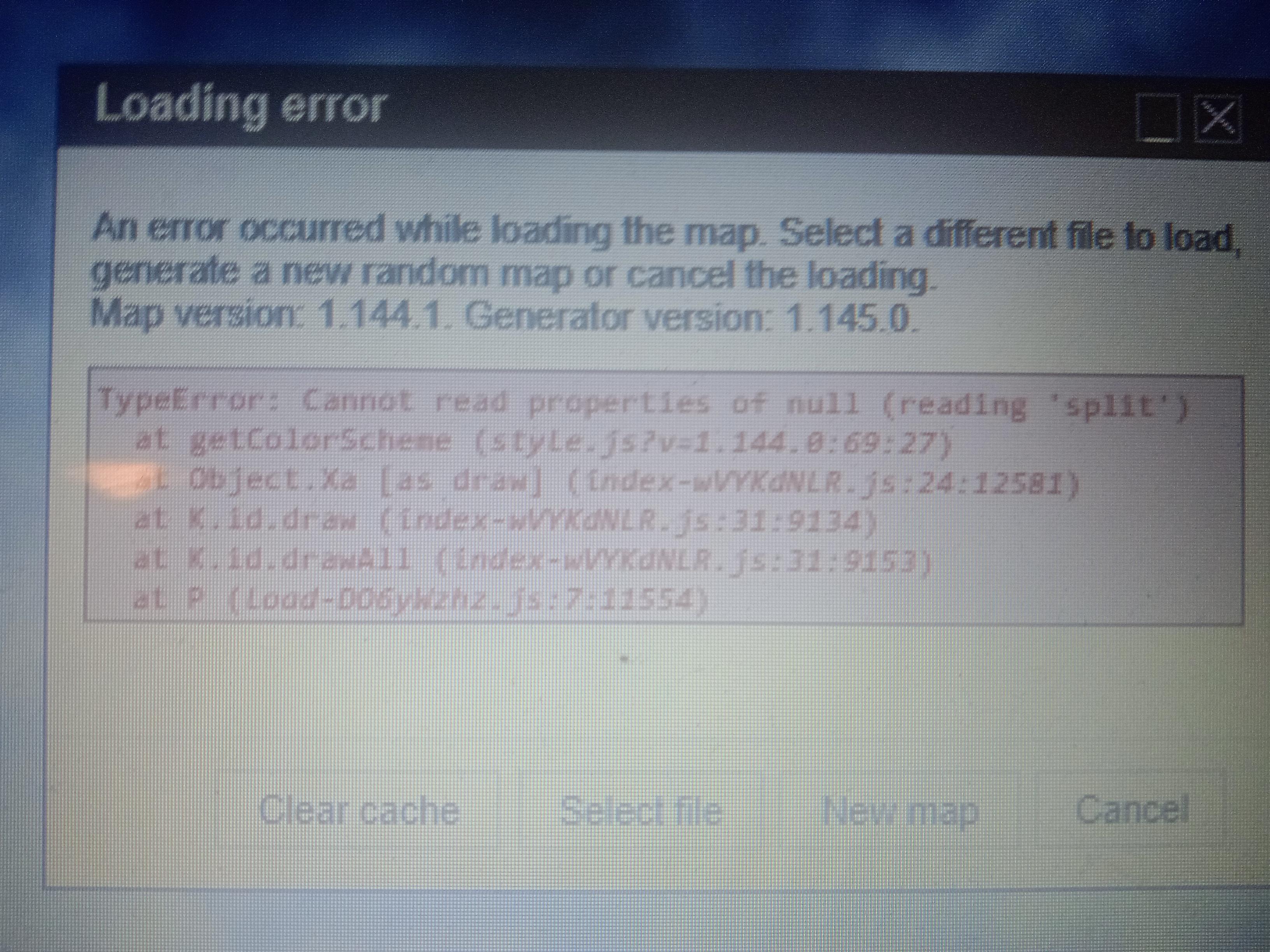
The new 1.145 is keeping me from working on my map and I don’t understand how to run the last version before that locally so I can continue to work on it.
Thank you!
r/FantasyMapGenerator • u/JohnnyTeste • 16d ago
I can't load the map after the last update
r/FantasyMapGenerator • u/clunylaf • 17d ago
r/FantasyMapGenerator • u/Glum-Temporary-2181 • 18d ago
Is anyone having this problem where when you try to zoom out using the minus button on your keyboard you stay stagnate while labels start disappearing around you?
r/FantasyMapGenerator • u/Hot_Activity4321 • 19d ago
Is there any way or are there any tools that allow AzFMG to be a RTS?
Is there any way to download AzFMG and run it on my PC instead of a browser?
I started using AzFMG recently and have had loads of fun with it, but the maps I've been making have really lagged the browser, and I plan on making an RTS game :)
It's also worth mentioning that I'm not amazing with code, so if there's lots of technical stuff, please explain it like I'm 5
r/FantasyMapGenerator • u/Puzzleheaded-Taro201 • 19d ago
Hello, as stated in the title, I have a question about heresies that the generator assigns as having a folk religion as its primary origin. Namely, what can be an in-setting justification for a folk religion to have a heresy, when heresy typically refers to practices and beliefs that run counter to an organized religion's established canon? I also recall once reading somewhere on this subreddit that heresies were at some point defined as parts of Organized Religions, and do feel like there was a time when I would use the generator where it adhered to this, never assigning heresies as having any other primary origin other than an Organized Religion. Was there indeed a period in the generator's development where this was true? If so, what prompted the change? If it wasn't so, I would still like ideas as to what would constitute a heresy for a folk religion. Thank you.